Expedition Airaavat- In the Shadow of The Celestial Elephant

Expedition Airaavat- In the Shadow of The Celestial Elephant

(Explorations in the Haathi Parvat Valley)

Time: 1230 Hrs 5th Nov 2009

“Woh nahin Sir, yeh pass cross karna hai”. Subhan said, his voice partially garbled in the radio transmission. Subhan, Vinod and Kundu were looking like three tiny specks at the feet of an imposing mountain.
“What???” I could not believe what he was saying. From where we were, this pass looked perched on top of a vertical wall of snow!

“Yeh to technical lag raha hai. Isse kaise cross karenge?”- Arun asked, his eyes still examining the objective carefully.
“Yehi Rasta hai Sir, hum kai baar aye hain. Doosra raasta me ek gulley hai. Bahut danger hai rock-fall ka”- One of the senior porters replied.
“Lagta hai rope lagana padega. Oopar thodasa technical climb lag raha hai”- The veteran –Jaisingh offered his assessment.

“Sahi bataoon? Yeh Pass mujhe bula raha hai. Chalo karte hain” Shahid said

All of us looked at him with utter incredulity. “Sheer Madness!! Let them take the call. Why are we suggesting?” exclaimed Rajesh not quite appreciating the enthusiasm.

“Sir yahan pass ka base main aa jao, phir decision lete hain” Vinod’s voice crackled over the radio. He was already half a kilometer away conferring animatedly with Subhan.

“Shahid bhai, map nikalo”- I asked of Shahid and he promptly obliged, with the the Google Earth printouts, neatly filed in a plastic folder.


Seven heads pored over the little printout anxiously to find any opportunity to avoid the sinister looking wall of rock, snow and ice.
Half an hour later, having not found any possible alternative,we decided to get a closer look at the wall. Meanwhile, Jaisingh had modified his views partially.

“Lagta hai, woh rock band ka niche se approach hai”- He said.

With reluctant feet dragging our tired bodies on that treacherously slippery slope of dry grass, we proceeded towards where the trio of Vinod, Subhan and Kundu sat huddled. Just behind them was the wall, which they called as Barmai Pass, the only reasonably safe passage from Kagbhushandi Taal to Alakananda Valley.
>>>>>>>>>>>>>>>>>>>>>>>>>>>>>>>>>>>>>>>>>>>>>>>>>>>>>>>>>>>>>>>>>>>>
Time 1300 hrs- 5th Nov 2009
“So guys, are we ready for the pass?” I was asking Negi and Bharat leading ahead of me along the already steepening slope.

“Kind of”- someone replied
“When you commit yourself to a difficult route, you don’t say kind of. You say, ‘I will do it’!” I said, thinking about the need for focus for the task at hand.
“We don’t have an option right?” – says Bharat
“Since we don’t have an option, we gotta say and believe, we are going to do it!” I was bit concerned about the team morale.
“We will do it” – shouted out Shahid, coming up few steps behind me.

So the team plodded on with mixed emotions and apprehensions.

>>>>>>>>>>>>>>>>>>>>>>>>>>>>>>>>>>>>>>>>>>>>>>>>>>>>>>>>>>>>>>>>>>>>
Time: 1530 Hrs, 5th Nov 2009
“Yaar pata hai kya? …hum mission pe mission accomplish kiye ja rahe hain,,,,,,,” Rajesh was jest fully serious saying this

“Aur har din naya mission khada ho jata hai”… I filled in and the team burst out into a hearty laughter. Bharat and Venky had just reached the top. Rajesh, Shahid, Negi and I had reached minutes before and had our fill of shooting majestic pictures from that high vantage point.

The laughter masked the great relief all of us felt after the tense moments few hours ago when we were committing ourselves to the route to the top.

Resting briefly on the top of Barmai Pass , we saw a bright orange glow of a sun was about to set- lighting up the snow-scape around for 270 degrees. Haathi Parvat stood gloriously tall with all its 6700 Meters, ruling over everything that was in our view North.

Shivering slightly with the onset of cold, these were the reigning thoughts in our minds -relief and disbelief.
We had just negotiated a pass, whose apparent degree of difficulty had sprung up as a nasty surprise in an otherwise pleasant Himalayan afternoon.

The mystical emerald lake Kagbhushandi Taal wasn’t yet finished with all the surprises it could throw at us, as we would find out soon.

>>>>>>>>>>>>>>>>>>>>>>>>>>>>>>>>>>>>>>>>>>>>>>>>>>>>>>>>>>>>>>>>>>>>
Searching for the list of high altitude lakes in Garhwal Mountains, this tongue twister of a name pops up all the time quite innocuously, “Kagbhushandi Taal”. For the un-initiated there is added confusion since there is a peak by the same name located not very far from the Haathi Parvat valley. To add to it all, the very lake is named as “Kankul Taal” in the British Army map that many of us use (freely available at University of Texas website), probably named after the Pass one uses to reach the emerald lake from the Haathi Parvat valley.

I went through all that a few years back in a frenzied December evening of Google Earth browsing, in the hope of a possible exploration of the route sometime in future.


View Kagbhushandi Route in a larger map to see this actual GPS Plot

The route plotted after the research veers off East from the famous Hemkund Sahib- Valley of Flowers Trail, first done by M/s Frank Smythe and party almost a century back, at Bhyunder village. It then meanders up along a small river till the head of the Haathi Parvat valley until it reaches the terminal Cwm presided by the 6700 mtrs high Haathi Parvat and another smaller peak “Oti Ka Danda”. From there the route turns south over the Kankul Pass and descends into the little boulder-strewn recess where the Kagbhushandi Taal is located. The route forth to Joshimath looked first a little unsure in the contour maps, at least for the first few kilometers, and then proceeded onwards along a ridge down to Vishnuprayag and Joshimath.

As it happens always, The Mountain bade its time and finally allowed me to go for it at last in the November of 2009. I was fresh from the Lamkhaga- Nalgan pass trek done in June, but still this one happened, barely four months later!!! To make it special two additional features were added to the itinerary.

  1. It was to be done in early winter (The usual season is in the mid and late monsoon)
  2. We were to explore deep into the head of the Haathi Parvat- Oti Ka Danda Cwm and locate an unmapped lake which was so clearly visible in the satellite pictures

As has been the practice in the last few years, a thread was floated duly in the Orkut and Indiamike community threads (lately I have had very high opinion of teams made out of the internet community- one gets to meet new friends and more often than not highly capable and enthusiastic ones). In due course of time a whole new team was formed (somehow all members of previous treks were in-disposed to join in)-another youthful team with widely varied backgrounds and profiles.

Arun Negi and Bharat Tomar came from the IT fraternity. Both fit, energetic and willing to brave it if the situation so demanded. Arun, the Handsome Brute-force of a Pahadi proved to be a solid anchor in the middle later on. Bharat- Loveguru- Tomar proved his mettle in his maiden trek. The Rajput from Haryana carried on his role, be it for team entertainment or bringing up the rear in a tough climb, with equal aplomb.

Ananda Kundu from Kolkata was the silent and gentle giant. A last moment joinee in his maiden trek, he fared well. The Robotics engineer-entrepreneur swore to take time out for exploring the mountains many times more, by the time we ended.

I had met Anand Venkat the first time browsing through some blogs, scanning some discussion thread on Kailash Darshan. Although we had interacted during some discussions on Mount Kailash, this was the first time we were going to be trekking together. I was shocked out of my mind when I saw the smiling young lad for the first time! Barely a facial hair on him, he looked the youngest. By the time we ended the trek, my respect for the Youngman had grown several fold. A tireless campaigner and silent worker, he works magic when behind his Nikon lenses.

Rajesh‘s hearty laughter and animated comments rang in the ears weeks after we ended the trek. The maverick ex-banker- Outrageous- NGO activist who is also husband to my ex colleague went out for the first time with me on a trek. Although we had exchanged notes several times on various trekking experiences, this was the first time we were together on one. He was the other senior citizen in the team (other than me).

Shahid Ali had earlier interacted in Orkut when he was planning his solo trek to EBC (Everest Base Camp). The Audiologist from Bangalore donned a commando look when in the mountains. Always willing to take up a challenge he proved good in all roles- Lead, Middle or bringing up the rear. No wonder he had earlier survived serious weather conditions in the foothills of the highest mountain peak on earth.


The Support team was interestingly structured as well. A 4-member core team was hired from Crystal of Uttarkashi (Old and trusted friends as Vinod, Jaisingh, Praveen and Anil) who then arranged the rest of the resources locally from Joshimath.
The porters were hired from a porter agency at Joshimath who also provided a local route expert in form of Subhan and the necessary permissions from the forest department. Subhan claimed to have done the route couple of times himself.

Day 0- Delhi- Joshimath ( 480 Kms drive)

I remember the long drive to Joshimath from Delhi as one that was tiring and draining but funny as hell!! One advantage of not having ladies in the team is, as a driver, you really don’t have to plan stoppages for such matters as relieving oneself. One could just stop anywhere you liked and felt like :-). I was happy.
Bharat, however, took some opportunistic advantages of that fact. “Dada, ek minute ek photo”, “Dada kuchh khate hain na”, “Dada thoda pani lete hain”, “Dada this and Dada that!!” Thankfully some of the many stopovers he proposed, allowed me to steal few winks of sleep. It is an additional fact that some fabulous shots have been shot during those myriad stopovers for toilet, food and just plain nature watching.


We started off from Delhi at about 0400 Hrs and were in Rishikesh by 0930 Hrs after some undue delays on the way due to fog and poor visibility. After taking a short power nap and some hasty South Indian breakfast, we were past Devprayag by 1300 and were in Srinagar for lunch by 1430 Hrs. Amidst some hilarious lectures and banters of M/s Bharat and Shahid, we were at Joshimath by 2000 Hrs. It was interesting to listen to the “Do-it-yourself course” for “50 dates in 10 days” by Baba Bharat. Anyways, happy ending for a grueling 16 hrs drive with no sleep in the previous night. Phew!

Once settled in the hotel, it was time to party!! Next day onwards it was walk all the way for 80 Kms!!

Day 1- Joshimath- Bhyunder Village (25 Kms drive and 9 Kms Trek)

Next day Vinod woke us up early at 0700. By the time we were lazily ready, it was 0930. It took another two and a half hour to actually begin the trek from Govindghat. Learning point!! It is better to stay at Govindghat than at Joshimath so that one can start trekking early. It is downright depressing to start a trek with the sun beating down harsh on your head.

After filling up water bottles at the Gurdwara at Govindghat, it was time to hit the trail. Old memories came flooding back as I started off across the suspension bridge over Alakananda, her waters bearing the turquoise hue, so typical of all Himalayan Rivers at this time of the year.

For someone who would have visited Hemkund Sahib and Valley of Flowers (the trail that we were on), the solitude and calm would immediately be apparent. In season, these very routes shall be teeming with thousands of pilgrims of all age and origin, the route would be lined with shops, trade would be brisk, the air filled with the smell of human beings and mule-dung, the chants of the people and the neighing of the horses filling the ears; I liked the change.
In the tough climb out of Govindghat, there was a funny interlude when w
e saw a signboard put up by the local managing committee, exhorting tourists and pilgrims to write their suggestions in the “Suggestion Rock”! Probably a minor error on part of the painter, but in that mountainous locale, with several utterly funny interpretations and visualizations.

By the time we reached the pretty Pulna village, we were suddenly aware that Vinod and the party of porters are far behind and faintly within radio contact.

Meanwhile I was enjoying the almost forgotten memories of a trek done 16 years back. The whole trail had changed so much since 1992 that it was like doing the trek anew. The colors of the fall added on to the novelty. Pulna village was probably a cluster of few houses when I visited the place a decade and half ago. Now it was a bustling settlement with a prominent concrete arch welcoming the passers-by. The sparse population of the village was merely a reminder of the season. Colorful Marigolds, Sunflowers and Dahlias adorned the area near the welcome arch. Bright red fields of “Chaulai (an edible “saag” which also bears flour bearing seeds)” lined the narrow dirt-road leading into the village.


We had not realized till then that this was only a trailer of the spectacle that the Mountain was going to unfold; a Himalayan Autumn surprise! The forest ahead wore various hues of red, yellow, purple, green, brown and a multitude of other shades; so vivid and colorful, one is reminded of flipping through the pages of a comic book.

Soon it was lunchtime and we stopped under a small cluster of sheds, which might have been serving as refueling point for hungry and thirsty pilgrims during the season. Now of course they were all deserted. Chomping through Paranthas and Pickles we had another hilarious discourse by Loveguru- Bharat about some theory on Chocolates and Women.

The only nagging issue in the mind was the slow progress of the Porters’ Team. They were yet to be contacted over radio!! It was 1500 Hrs and we were already half way through!! At that rate, we would be at the designated campsite by 1700 and wait for the porters to arrive by 1900!

“Not a nice idea”, I mused. For a moment I regretted not getting porters from Uttarkashi, who were familiar and whom I trusted not to turn their back at the middle of the trek. We decided to wait for the porters for the simple reason that we needed to be sure that the porters were coming after all! No point waiting for them at Bhyunder village without a fall back option for the shelter for the night.


The problem resolved itself 45 minutes later when the porter team finally came up. After a sharp and pointed communication with the Porter Sirdar-Dalbir and Subhan the local guide, we proceeded towards Bhyunder, relieved and hopeful.

Just as we were witnessing the first views of Snow over the Nar Parvat, part of the sky clouded up. It can be mesmerizing to see the reddish-yellow hues of the setting sun juxtaposed with the grayish rain bearing clouds, walking on the picket-fenced boulevard at Bhyunder Mall 🙂

It is difficult to put to words, the subliminally divine experience. The gentle drizzle, the whispering susurration of the breeze carrying colorful leaves of the fall, the baby goats calling out animatedly for their returning mothers, the patches of snows and clouds in the high mountains difficult to tell one from the other- all of it just whisked one off to another world.


By the time we reached the village the rain had increased intensity and we found some of our members in the advance party resting on the verandah of the village temple. Praveen was already cleaning up the Verandah for camping there for the night. This is one characteristic of our support team I have never been able to understand. Even when there is a perfect campsite, so close to water and a relatively friendly weather with plenty of firewood for a grand campfire, they would always rush to the nearest concrete shelter! For us citi-breds, dying for a camping experience, it becomes slightly incomprehensible at that moment. (Of course we conveniently ignore the labor they have to put in to pitch the tents in and then pack all of it back in the morning before starting the day’s walk ;-))

We insisted upon camping down on the little field across the bridge over Laxman Ganga. This is where we were to veer off from the VoF route and catch the robustly constructed trail into the Haathi Parvat Valley. In about an hour everybody assembled at the camping ground. By the time tents were pitched, it was already dark. Price paid for starting off late.

The first day had taken its toll. The tired limbs, however, were soon forgotten as soon as Vinod and Jaisingh got a massive campfire going. After fervent experimentation with night shooting by the light of the campfire, it was time for dinner. There was some jesting talk by Jaisingh about possible visit of bears from the nearby Jungle. I was almost about to scream in the middle of the night when a restless Rajesh went looking for a suitable place to relieve himself. Thankfully I did not 🙂

Day 2- Bhyunder- Semartoli Bugyal- Dang Kharak Glacier Camp (8 Kms Trek)

The larger the village, the eerier it looks when deserted. Watching the silent outlines of the Bhyunder village, still shivering by the small campfire, I was thinking of the day ahead. The small camp was stirring lazily to life. We knew we had a long walk ahead. We had targeted reaching the head of the valley, if we were to spend any meaningful time exploring the glacier and looking for the small un-mapped lake.
After some easy idle talk, we were all ready in a hurry and had hit the trail by 8:30 AM. Good show! I thought, we all had been regretting the late start, the previous day.
Not long after the Bhyunder camp, the jungle grows even denser. The well made Chhe-phuti (6 Ft wide) trail twists its way through the abundance of conifers, all of them rich with their zillion colors of the fall.

Dry maple leaves with their shades of red, brown and yellow carpeted the track amidst faint piercing calls of crickets. Not a bird to be heard or a call of a monkey. It was a silent pleasure walk with a colorful canopy overhead through which the sun pierced in with numerous needles. One could hear a distant gurgle of the river we were following up east. Who would not treasure those moments of total immersion and silent reverence for a force so powerful yet so eloquent and pretty!


After an hour of walk one reaches a small opening (probably can serve as a camping ground for a small party) from where the mighty bulk of the Haathi Parvat reveals itself over the tree line.
Shortly thereafter one crosses a concrete bridge to cross over to the river’s true left. Just after crossing the bridge the route seemed to disappear beneath the thick undergrowth. Watchful eyes tracked the route back and soon we were over another makeshift bridge back to the true right of the river. From now on, we would remain on the true right till we cross it over at its origin near the Chainyal Kharak camp.


That’s when Shahid Ali declared, he has lost his newly-purchased-highly-admired-Singapore-sourced-Casio Protrek watch somewhere on the way. As usual, the “lost-and-found” service of Praveen Negi was employed. Commando Shahid insisted upon accompanying him in the adventure. Thankfully both of them returned successful and tired after one long hour. To cut a long story short, this little accident set us back by 90 minutes against the planned timelines.


The trek resumed with several necessary halts on the way. The view was so breathtaking, one had to stop to shoot the pictures. Timelines could wait for a while J. At Kabassi Udiar, about 2 kms from the bridge, one could see several large rocks that might be used for shelter (for humans as well as bears). Here Jaisingh did some digging around for medicinal herbs (He called it Chaura- used for cold and flu apparently). After this lovely meadow, one crosses three dried up nullahs and a dense jungle to reach the next camping site. These streams were bone dry, even in the month of November.


After about 6 Kms from Bhyunder camp, one reaches a large undulating meadow through which a highly meandering trail passes (one wondered if the route surveyor was following the proverbial path of the calf) to lead on to a beautiful campsite. On a good day, if the team plans well enough, it is possible to reach this campsite, Semartoli, in one-day form Govindghat.

The camping ground is a dream of a campsite for any size of the group. A lone ashram of a Baba looks over the twisting course of the river from the gentle slopes that lead further east towards the head of the valley. The Ashram was deserted however. Waiting for the rest of the party to arrive, I lit up a small fire. The sun was faint with wisps of clouds filling up the sky and it was becoming cold waiting in a half-hearted Sun.


Even as we had our lunch I could overhear the porter team grumbling yet again about the distance and the load. We had barely crossed 6 Kms and they were at it again!! I had to do some essential hard-talk.
“Aap log agar aise hi karte rahenge, ya to hum tour cancel karenge ya phir apna load khud carry karenge. Yeh kya mazak hai?”- The anger was presumably a manifestation of the helplessness inside. ” Aage char kilometer aur chalna hai camp ke liye.” I warned.

“Koi baat nahin Sir. Chal lenge.”- The Porter Sirdar Dalbir said.

They all nodded and carried on. The valley after Semartoli widens up quite a bit and in about 2 Kilometers enters a rocky flat. The PWD trail disappears into the boulder-filled riverbed once too often, the route barely marked by parallel lines of outlining rocks. From a distance we could see the denuded ridges of the Dang Kharak glacier. The Google Earth print-out and the GPS position locator were once again deadly accurate in navigation.

We were soon standing beneath the giant wall of the Dang Kharak glacier even as the pregnant clouds overhead hinted of a snowstorm. The wind powered up and little flakes of snow came floating down.


“Abe kya kar raha hai? Direct snow kha raha hai aasmaan se?” I asked Arun Negi

He had his mouth wide open, skywards, trying to catch the falling snowflakes.
Subhan was following closely behind. Looking at the weather and the gloomy outline of the Cwm area ahead I decided to camp.

“Yehin camp karte hain Subhan”. The GPS readings said we were short by 2 Kms from our designated target. But looking at the condition of the team, especially the porters and the weather condition, a call had to be taken.
“Lekin sir, yahan koi campsite to dikh nahin raha hai” Subhan said, scanning the boulder-strewn riverbed.
“Koi baat nahin bana lenge!”- I said.


I was hopeful; we should indeed find some leveled patches where we could pitch the tents. The waters of the river gurgled nearby and a birch forest was not too far away. Water and fire and some level ground! That’s what we needed for a camp in any case. Soon after the tents were pitched, all of us spent considerable time gathering firewood. By the time the sunset, we had gathered at least a quintal of fuel for our campfire.


As the clouds dispersed and darkness fell, the glorious view of the Haathi Parvat revealed slowly. The giant mountain and its less lofty subordinates were completely awash with the gentle brightness of a full moon. The -6 degree cold did not deter us from trying out night-shoots in our respective cameras from different angles. Far away in the West, the pinnacle of Mt. Neelkanth peeked from over the ridgelines of the Khuliaghata ridge. Talking late into the night, gathered around the campfire, the imposing walls of the glacier almost behind us, the whiteness of the snow kingdom visible ahead and all that moonlight magic!! It was another world.
In the maps, Chainyal Kharak (also called Raj Kharak by some local tour operators) is indicated as the final camping ground before reaching the Kankul Pass. We aimed to camp there or any other suitable camping site closest to the base of the pass and then spend the day exploring till the end of the medial moraine of the glacier. By all estimates, the campsite would not be more than 4 Kms, I reckoned.

Day 3- Dang Kharak- Kankul Pass Base Camp (5 Kms)


We lifted camp a little late at about 0930. The day was sunny as usual. Thanked The Mountain for one more day of blessing. The peaks shone gloriously to the North almost over our heads. The Dang Kharak Glacier was a stone’s throw away. Negi, Bharat and Kundu had decided to team up together and keep equal speed. Rajesh and I led ahead quickly along with Vinod and Jaisingh. We had to reconnoiter a suitable campsite that can help us launch our exploration into the Cwm and serve as a base camp for the pass at the same time.

The steep climb over the moraine ridge on the true left of Dang Kharak glacier, leaves one with bit of a shock. By the time we regained our breath on top of the rise, it was already 1100 Hrs. For some reason, we were having quite a leisurely walk. I wasn’t quite sure if it was the altitude or the anticipation of an early camp or just plain laziness.

The route, expectedly broken around the glacier snout requires a bit of exploration. In the monsoons it can be a bit of a task crossing the river there. The team spent quite some time shooting pictures near the snout.


I was beginning to have bit of a problem with the eyes. A combination of snow and altitude does it to me always. However, this time around there was help at hand in form of the little vial of “Lubrex” that Rajesh was carrying. We stopped several times to administer numerous drops of the magic lotion in my eyes. This shall be a necessary item in my medicine chest from now on.
“Lagta hai koi party aa rahi hai udhar se”- Vinod said squinting against the sun looking at the few people coming towards us from the opposite direction.


“Kahan se aa rahe hain?” I asked the couple of men who came near. They were loaded heavily and also armed with shovels and axe. For a moment, several unsavory thoughts popped in the mind about possible snow conditions ahead.
“Aage se aa rahe hain. Raasta bana rahe the. Snow zyada hai. Wapas jaa rahe hain.” One of them said.

We soon gathered that they were PWD workers, who were calling off work for the season due to heavy snow conditions. The PWD has done some excellent work in building this trail right till the base of the Kankul Pass. One might wonder why, given the virgin-ness of the valley.


“May be the Government wants to popularize the trail for tourists”, I thought.

This group of workers had another gift for us in form of a well-stocked and well managed camp at Chainyal Kharak as we were to discover pretty soon. The campsite is at the right edge of the medial moraine across a small stream. The team regrouped slowly, a little after midday. Kundu suffered a minor and unnecessary fall into the waters while crossing the stream, rendering the trousers and the shoes completely wet.

From the campsite, a little depression is visible due south over a bounding ridgeline. That was the first view of the Kankul Pass. Even in the bright sunshine, the tall and jagged outline was awe-inspiring.
After a quick lunch it was time to go exploring the head of the valley in the hope of locating that little lake, yet unmapped but visible from the manmade eyes in the skies. Kundu decided to stay back, still trying to dry up his shoes and clothes.

With Dalbir in the lead and Subhan and Jaisingh as assistants, the team started up towards the valley-head flanking the true right of the medial moraine of the Kankul Glacier.

This glacier emanates from the feet of “Oti Ka Danda”, the dominant peak guarding the Eastern extreme of the Haathi Parvat valley. The lake was expected to be seen somewhere at the base of that peak, slightly to the west.
Countless boulders numerously punctuated the laborious climb up (a feature that would be our companion for next couple of days, we were yet unaware). Finally the group reached a moraine mound blocking the way ahead. Rajesh and Bharat had decided against the late-afternoon-boulder-hopping.
“Reached back camp buddy! Best of luck! Not feeling too well. Bharat is also with me, he had bit of a stomach problem”- Rajesh radioed in.

“Dalbir ko bhejo aage Subhan. Is chadhai ke baad lake mil sakta hai” I told Subhan. The GPS mapping showed, we were very close to the edge of the lake.
Dalbir and Jaisingh went ahead following two different routes. The climb up was in knee-deep snow, probably for about a hundred vertical meters.
By 1520 Hrs Dalbir shouted back- “Lake mil gaya sir!!” Jaisingh also radioed back the sighting of the lake 10 minutes later.

Arun, Venkat and Shahid had gathered by then at the base of the mound, all of them raring to go for the top. I stayed back behind overseeing the respective routes up and coordinating messages through the radio.
“It’s okay guys. Go ahead, but do start back the moment it is 1600 Hrs, whether you have seen the lake or not” I was worried about the clouds gathering up above.

“Aye aye Sir!!” said Arun. They took a sip each from my hydration pack and up they went.

After a bit of a struggle in the snow, the team reached the narrow bank of that little un-spoilt beauty.
“Ashu Sir!! Lake sighted and conquered!!”
Shahid was loud and clear on the radio in what can be termed as his characteristic “Victory Cry” upon attainment of an objective 🙂
As agreed, they all started back in time and the team was back at the camp by 1800. Rajesh and Bharat had set up an ingenious hearth as campfire, inspired by some description in the book that Rajesh was reading. It was indeed, a fine contraption in that windy and flat place.

“Dada maza aya na campfire me?” Bharat would have asked me the same question at least three times that evening. Obviously he was happy with his Joint Venture handiwork with Rajesh.

Happy conferencing followed, sipping on tasty Daal borrowed from the Porters’ kitchen around The Campfire. Everyone was discussing the interesting little excursion and exploration of the unmapped lake. We decided unanimously to call it the Haathi Taal- named after the presiding peak of the valley.

The salient aspect of the evening was, however, the delicious Jacket Potatoes that Bharat produced from the campfire. The barbecue, suitably interspersed with jewels of wisdom about women and love, lasted late into the night.


“Yeh ladkiyan jo hoti hain na dada…” and another long discourse from Bharat Tomar would follow.
That was the first of the many times that Bharat’s culinary expertise was to be tested, with resounding success, if I may add.
“Age se, bade bade alu layenge, agle trek ke liye” that was the final decision that night J Bigger potatoes made better jacket potatoes 🙂

Day 4- Over Kankul Pass to Kagbhushandi Taal (8 Kms)


Thankfully the skies opened bright and clear, the next morning. That is a piece of luck every trekker prays for in the high mountains, especially in the winter. Any precipitation in this season means heavy snows in the high passes, which makes even a hundred feet look like a mile of ordeal. All in high spirits, the morale high with the exploration of the previous evening, the team set out for the Pass.

We were to cross the pass and camp near the Kagbhushandi Taal by the end of the day. The distance wasn’t much, but the difficult terrain would take up much of the time. “Difficult Terrain” was an understatement, as we would realize not long after.
The trail to Kankul Pass from the Chainyal Kharak campsite winds up in a confusingly serpentine fashion towards the general direction of the pass. Since Kundu was suffering a bit from exhaustion, it was decided to send him ahead with Jaisingh an hour before rests of us were to start. Just when the duo vanished ahead of the last visible bend on the trail, Rajesh and I started off.

About a kilometer later the faithful and well made Chhe Phuti, which had been our companion since Govindghat, just trailed off; probably a result of the abandonment of work by the group of PWD workers whom we had met the previous day. Jaisingh and Kundu were nowhere to be seen. We decided to follow the general direction where the trail was headed last and found ourselves standing on the left edge of the medial moraine.
Beyond a ravine below, the tall ramparts of the ridge rose several hundred meters above us, due south. A gentler slope leading to the top could be seen further east; in fact Subhan had indicated that to be the route the previous evening. We failed to notice Jaisingh and Kundu trying to follow a shepherd trail directly due South where the forbidding wall of the ridge rising above us. We decided to move east towards the slope.

The entire team was on the move now, following different trails, generally guiding each other over voice and radio calls. Just then someone pointed out Jaisingh and Kundu trying to negotiate an alternate trail that looked fairly challenging from where we stood. Upon our repeated calls to come back and join the route we were following, Jaisingh radioed back his confidence about the route he was following with characteristic nonchalance.

“Poora rasta bana hua hai sir idhar se. Bakri wala rasta hai. Boulder aur snow bhi kam milega.” – His voice came over the radio.

“Ooper difficult lag raha hai Jaisingh.” I radioed back anxiously.
“Maine dekha hai Sir. Kuch problem nahin hai.” – He replied. I could imagine the impact this conversation might be having on Kundu’s morale and decided to trust the instincts of the veteran.


There was a quick consultation among Vinod, Subhan and I. We decided to proceed fast and be at the top, where the two routes appeared to converge, as soon as possible. In case any help was required in terms of fixed rope, Vinod could then go down and help Jaisingh. We should have known the old man better, as we would realize later.
The real ordeal started after that. Soon we were to realize, how true and correct Jaisingh’s gut-feel was!

“These sherpas have a way with smelling their way through. This bugger Jaisingh practically sniffs his way out!” we would discuss later that evening.

Where the rock and shrubs of the medial moraine ends and the snow & grass covered bouldered slope starts to the top, there is a small glacial tarn. I noted it for future reference. It could be used as a bivouac site or for setting a small base camp for the Pass. The immediate increase in the steepness knocked the wind out of us. Soon we were boulder hopping, each hop becoming longer as we proceeded ahead.

At one point, Rajesh stopped. Huffing and puffing heavily he put his trekking pole between two boulders, which clearly indicated the gap to be close to 6 feet.

“Yeh saale porters load ke saath jump maar ke jaa rahe hain kya?” said Rajesh, he had that familiar look of exaggerated disbelief J

In that section of the climb we were basically following the porters, who appeared to be flying across the boulders. Vinod and Subhan were much further ahead aiming to reach the junction point from where they could oversee progress on both the routes, one that we were following and the one that Jaisingh was following with Kundu.

By the time we reached the junction point, all of us were totally exhausted, frustrated with the snow, run out of drinking water and hungry. We had not had a morsel of food since morning and it was already midday. The saving grace was the clear sky and the blazing sun overhead.

We tried having some chocolate bars and some ice-melt for drinking. I still remember stuffing my hydration pack with powder snow, desperate to have some water for the climb ahead. Soon Jaisingh and Kundu appeared. Kundu was exhausted too from the steep climb. They however, did not have to go through the painful and risky boulder hopping that we had to do. The mountain had a different challenge for everyone.

Little had we realized that we were only half way through the climb! We still had to cover 400 more vertical meters. The climb was divided into three distinct stages, each stage visible directly ahead from where we stood. The first two stages were through brown and dried grass over a steep slope. The final stage was along a wall, the track made of rock and snow. We had to hurry, if we were to cross the top before the iffy mountain weather played truant in the afternoon.

Rajesh and I took the lead again. The steep climb ahead was on slippery dried grass. Far below on our left lay an angry bed of boulders awash with brilliant-white snow. Hungry bodies and thirsty throats struggled for balance. On such slopes essentially one walks on the sides of one’s feet. Prolonged exercise of this nature become agonizing for anyone. The porters seemed to be forever ahead of us. They were now showing their true mettle after all the grumbling in the previous days.

Resting under a rock after the first step I chanced to take a look around. The proud Hathi Parvat stood tall directly North of us. The Kankul Glacier lay below its feet with a East-West orientation, looking like a wide highway constructed with great care. The surrounding peaks at the head of the valley, due East stood encircling the head of the glacier as if blessing it with silent magnanimity. Small crevasses on the glacier and its medial moraine were visible from where I stood.

I could make out the small depression where the Haathi Taal (one that we had explored the previous evening) might be located. The Taal, however, was not visible. It wasn’t visible the entire way till the top; one of the possible reasons why it might have been uncharted in the British Army Map (1937).

Soon the rest of the team caught up and we had to plod on. After a long, tedious, highly punctuated and exhausting hour we finally caught the summit slope.

“Wo raha pass”- Subhan said. “Dalbir pahunch gaya hai do porters ke saath.”

Seeing the small cairn from that distance, our morale perked up. With Subhan cutting the route through knee-deep snow I finally reached the top at 1430 hrs. The altitude reading had beaten my calculations. We were well over 4700 mtrs at the top of the pass, 4713 meters to be precise.

Beyond lay the Kagbhushand Gaad valley leading on to Alaknanda. The comparatively low-lying Shivalik mountains appeared ghostly on the horizon with their faint purple-blue outlines. Looking back one could see the Haathi Parvat valley and the slope leading to where I stood. I could see our team snaking its way up. A large, lazy and struggling snake :-).

Rajesh reached up soon. As he reached the top his hands folded in salutation to the great Mountain, as if he was seeking blessings and was thanking the King of Mountains for have ended the trying part of the day. In the next one hour all of the team members arrived one by one- first Shahid and then Arun, Venkat and Bharat Tomar. Kundu was much far behind struggling his way through the deep snow.


“Kundu! We have reached the Pass.” – Shahid was shouting at the top of his voice into the radio, exhorting his tent-mate to come on.

“Aa raha hoon main” came the disinterested reply. He obviously had more pressing matters at hand to deal with, all that rock and snow and slippery ground J.

After waiting a while, we decided to leave Subhan behind to wait for Kundu and started for the camp. Some porters had gone ahead to look for campsite near the Kagbhushandi Taal. We were eager to join them. All we needed was water to drink and the warmth of a sleeping bag.

(We had earlier planned to camp much below the Taal. The time of the day, body conditions and the ever increasing thirst forced us to abandon plan and we had decided to camp near the Taal for the night, even if it was cold. It was going to be our highest camp at 4350 mtrs.)

The boulder hopping started again, albeit for a much shorter duration. With the mind divided between the boulders and the safe arrival of Kundu, we finally reached the end of the platform from where one could see the emerald jewel- Kagbhushandi Taal.

Soon the tents were visible, pitched right near the West bank of the lake. The team morale shot up again and we all were at the camp by about 1600 hrs. Just when we were about to rest in the dying rays of the setting sun, Subhan appeared informing us that Kundu had crossed the Pass 15 minutes back.

I think, the sun set the fastest that evening. By the time we had finished clicking couple of snaps of the beautiful lake, darkness was descending with cold ferocity. Before long, the temperature began dipping below the zero mark.

With the headlight glowing on his head, Kundu finally appeared. I was waiting for him outside the Kitchen tent. He rested on the rock alongside and almost collapsed. The gentle giant had been drained off his last ounce of strength.

No campfire that night. Food was served inside the tent as members refused to brave the cold outside. Shahid was heard discussing the day with Kundu late into the night. By now, it was habitual to hear Shahid giving a motivational spiel to his tent mate for several hours. I was happy they had bonded well. All that bonding was going to be necessary for the challenge ahead, challenges I was not yet aware of.

Day 5- Kagbhushandi Taal – Barmai Pass (4513 Mtrs) – Upper Barmai Camping Ground (6 Kms)

It was a visual treat next morning.

The large water body of Kagbhushandi Taal appears emerald green during most part of the day, possibly due to the immense depth. When you combine that large emerald with its lightly shimmering tranquil waters, with the snow covered mountainsides, the thin morning mist that hangs above it and the early rays of the rising sun that light up the lofty peaks around, you are transported to a different dimension. Even for the non-believer there would be a moment of silent gratitude for all that sublime beauty.

A small river emerges from the Southwestern corner of the lake, the point well marked with a cairn. The route to Joshimath touches this point, rises over a mound to its south and descends further ahead. We watched Subhan and Kundu disappear down that route around 0730 hrs that morning.

To reduce variability in arrival at the evening camp we had again requested Kundu to start early, for which he sportingly obliged. In fact he had slept with his shoes on, the previous night to reduce start-up time in the morning. Dedicated lad he was!!

With the bright sun beating overhead, we proceeded down to the very edge of the waters of Kagbhushandi Taal and then over across the steep contours of the mound to the south. The view beyond opened up into a huge bowl of a valley. Further south a wall of high ridges blocked the way.

Seeing this on Google Earth I had earlier charted a possible route along the riverside down the South West. Subhan, Kundu and few porters were well ahead of us. Vinod and Jaisingh, new in the area were leading us across the mountain face locating distant cairn marks. Till then I was thinking that the route was across a n easy looking pass to the South East. However, all doubts were put to rest when Subhan said it over the radio.

“Sir, woh samne raha pass.”

“Kaun sa Subhan ? Woh bayen wala? Jo boulders dikh rahe hain?” I asked to clarify.

“Woh nahin Sir, yeh pass cross karna hai. Dahine wala..jo wall dikh raha hai”.

What happened after that is narrated as the opening scene of this article. We were stunned for a moment looking at the obstacle. It was forbidding in the strictest sense- The Barmai Pass.


This must be one reason why not too many successful accounts one reads of about the crossover to the lake from Joshimath and back. There is this most imposing wall of a pass that stands in between the leading ridge to Joshimath and the emerald lake.

Few hours later, marveling at the 360-degree view around we looked down into the other side of the watershed. While the climb up to the pass was a struggle in powdery, unstable snow, the other side looked frustratingly boulder-strewn. No one amongst us liked the remembrance of the toil of the previous day. However, a camp had to be reached, before sundown.

“Mera jute ne dhokha de diya dada” said Bharat, he wasn’t looking too happy with the experience of treading through powdery snow on that 60 degree slope.

This time around we waited for Kundu to reach the top at 1600 hrs and later proceeded down together. I also recall, quite fondly if I might add, the animated conversation Arun and Bharat had with some lady friend ( the GSM phones were suddenly detecting telecom traffic once we were atop the Barmai pass) and how Bharat forgot the name of his tent-mate Arun while handing over the phone.


The camp that night was on an ideal camping ground, the Upper Barmai camping ground. The campsite is in a deep recess with an absolutely flat ground. To the west, a deep valley leads forth. One of the senior porters showed us the deep gully coming down from the ridge to the south. That was the alternate route to Barmai Pass. It is a decent route for one or two people. But for a team of 20, it is like inviting disaster. We were happy with our decision.
The campfire was with freshly cut Juniper bushes. With the fragrance of the Juniper hanging on our jackets we retired into our sleeping bags early that night. Enough of struggle and surprises for one day!!

Day 6- Upper Barmai Camping Ground- Pharsawan Bank- Vishnu Prayag (20 Kms)


It was evident from the location, the previous evening, that the Sun would break late at the campsite. It is in fact located in a deep recess, much far down the contours of the mountainous ground around. Having finished our morning chores early, in the chilling shade of the surrounding mountains, we were off for the day’s hike by 800 Hrs.

As an interesting aside, Arun Negi reported of a stubborn bird that teased him all the way through his process of ablution. While Arun was in a sensitive and vulnerable posture (squatting on the rocks J) the bird would start calling out and stop the moment Arun turned around with much effort at balancing. We named it “Shaitani Chidiya” -The impish bird.

As usual, Subhan and Kundu had left early. After his tough experience with Jaisingh on the day of Kankul crossing, Kundu now preferred Subhan as his lead. Today we had to reach a hilltop, Pharsawan Bank, due South West. One expected to get a well-constructed Chhe Phuti after that, leading all the way down to Joshimath.

After bit of confusion in the route ahead, we finally hit a proper trail and were on the Hill top of Pharsawan Bainak ( I am yet not sure about the name, whether it is Pharsawan Bank or Binayak or Bainak- Bank would mean a glacier, there is none. Binayak would indicate a Ganesha temple, there are some deities in the little stone temples at the top, but none of Ganesha)by 1000 Hrs. Altitude reading: 4215 Mtrs.


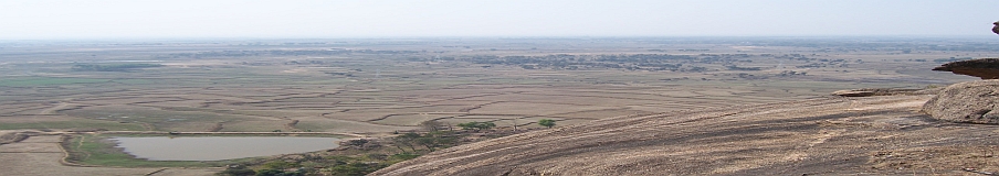
Kundu, Rajesh and I were there almost at the same time. After a brief talk, Kundu left and we waited on enjoying the sprawling view of the Alakananda Valley with Auli and Gairson Bugyal directly ahead. One could see the white dots of the buildings detailing the Joshimath town. I wondered for a moment about the extent of descent. It is only then that I realized the challenge ahead for the day.

Assuming, the Alalknanda road-head at a minimum altitude of 1800 mtrs, we still had about 2400 mtrs of descent to do!! (It later turned out that, Vishnuprayag was, in fact, at 1600 mtrs and the total descent from Pharsawan- 2600 mtrs).

The entire troupe regrouped there by 1100 Hours. During the short stopover there, Dalbir sustained some bloody injury on his forehead. In the usual lively banter amongst the porters he had rolled down over and hit his head on a jagged stone. The crisis was quickly attended to with state of the art first aid from our medicine chest. A brief photo session thereafter it was time to start the Grand Descent.

And Boy! Was it a descent? It was the Mother of all descents I have seen in my life.!! The route undulated up and down (but generally down) till we crossed two small passes (in fact, transverse high spurs along a North- South ridge that led all the way down south).

After the second high point, there was a sharp descent of about 400 mtrs ending at a trough on the ridgeline. After reaching there we saw another gigantic descent down on the other side of the ridge. The muscles in the thigh and the calf were already protesting when we looked down at the tiny Painkha village form that high vantage point. This place was called Jabar Kharak. The first camping site if we were to attempt this route from the Joshimath side.

“Paani hai?” some one enquired. We looked at each other and were to our own thoughts for a while. We were running short of drinking water yet again.

“Jaisingh aur Praveen aage jayenge aur Paani ke pass rukenge”- Vinod said. The dreadful descent ahead of us, we trode on the path ahead, with parched throats- our minds singularly focused on getting some water.

 
We lost the count of the number of hairpin bends we negotiated. What I remember is the several near-falls I had, my shoes slipping on the thick foliage, which sometimes blocked and sometimes carpeted our track. Shahid was just ahead of me, desperately searching for water and a leveled patch of ground where he could offer his Afternoon –Friday prayers. But he would have no such luck.

Finally, the good news came around 1400 when Praveen informed the team that they have found water.

“Paani mil gaya sir.” – said Praveen over the radio

“Kahan mila, Gaon pahunch gaye?” I asked.

“Nahin sir, Gaon to nahin hai. Yahan jungle ke andar Paani ka dhar mil gaya. ” he informed.

That’s the only place we have rested during the descent. After some quick refueling of water Shahid, Rajesh and I started off again. There was a bit of confusion in the route ahead. But soon we hit a Chhe Phuti trail and we were at Painkha village by 1530 Hrs.

The village wasn’t as deserted as it was in the Laxman Ganga valley. The village was well inhabited and was looking in good economic health; probably because of the proximity to the Joshimath town.

From now on, the trail became a concrete track- much more defined and sure; but a tad difficult to walk on. The speed became faster as the black line defining the national highway loomed into view. I was at the road-head by 1630. Rajesh, Shahid and Bharat arrived within the next hour. Phew!! The final calculation showed a total descent of 2630 Mtrs. My biggest descent so far! Never ever in my life have I descended 2630 meters in one go in a single day.

There was news from the top, that Kundu is unwell and might have to be rested at Painkha village at night. None of us liked the idea. A horse owner was found hastily at Vishnuprayag and his horse was pressed into service to retrieve Kundu till road-head.

Bisht, the faithful mountain driver was waiting with his Mahindra Commander. Two ferries of his vehicle were required to evacuate the entire team, luggage and equipment to Hotel Trishul at Joshimath.

Waiting for the quorum to build for the first ferry, we witnessed the most majestic view of a family of Himalayan Thar on the right bank of Alaknanda. A whole family of Thar was grazing, the calves cavorting and the bull and the cow desperately herding them in. The Thar is an interesting cross between a wild boar and a goat and an Ibex. It is powerful yet agile. The spectacle lasted for a good half an hour.

By the time, the second ferry of the Mahindra Commander arrived at the hotel it was 1900 already. A celebratory party was hastily organized for we had to leave early next morning. Rajesh ruled the roost that evening, recalling and narrating and re-living interesting moments of the week gone by.

Saying Bye Bye…
As usual, the Mountain gifted. Yet again, not just the elevating experience but also another bunch of dear friends. As it happens always, one is tied together initially by a common purpose. The extreme life on the mountains however, lets one discover several aspects common and aspired in each other and you become friends for life, without even realizing. It was like going back to college days, in the company of these sprightly young-men (Rajesh looked younger than them all in bearing and demeanor as well). The drive back to Delhi was relatively more continuous and less time taking. After a 16-hour marathon we were back in the city well before midnight.


Apart from the team (diverse, jolly, fit and tightly knit), the trek stood out for a few more points worth remembering. The time of attempt of the route, the exploration of the glacier & Haathi Taal and the 2600 mtrs descent were all unique in their own way. Not a single soul, or an animal was sighted for better part of the way and when it was time to sight one, it was a whole family of the rare Himalayan Thar. The virginity of the route was abundantly evident the moment we headed East into the Haathi Parvat valley.

What remained, as a nagging thought, was the omniscient scarcity of water. The streams were thin and the nullahs dry. The relatively fresh moraines near glaciers indicated some fast recession. The lovely stream bed of Barmai Camping ground looked like a cobbled street.

Probably, there just wasn’t enough glacier ice to provide the melt water. The Kagbhushandi Gaad was without water. During the long descent in the last day, during that desperate hunt for water, we did cross several streams. But all of them bone dry. The entire mountainside drained into but a small stream, carrying about four faucet-full of water! Observe keenly, and it points at the dying throes of an already-fragile ecosystem.

What tragedy! Here is the highest landmass of the world, many nooks and crannies yet undiscovered and unexplored. Here is the third highest freshwater reserve in the planet (apart from the two poles) that has fed some of the fiercest and mightiest of the rivers. Yet it dies before our very eyes. Withering away slowly, even before being seen completely.

*******************************************************
The Captioned Album of the team’s Pictures at

Expedition Airaavat

Facebook Albums

************************************************************************************
 
The Interested might wish to see some of the excerpts of team DVD at
 

[Published under the author’s permission ]     

[ Original publication at www.snowscapes.blogspot.com on January 23, 2010–the readers are requested to express their comments on the original Blog as mentioned above ]

Shwet Digant (Part 1)-Twin Passes Trek- Nalgan and Lamkhaga Pass

She was watching eagerly as Jaisingh helped the last of the members hop across to the other bank of the angry river. Did I notice a sense of despair in those innocent eyes?

I realised all of a sudden, that the entire group of 30 Men (and women), who had by now crossed over already, were watching her with equal eagerness. For a moment, the sound of the roaring waters ceased to exist as my mind went numb with helplessness!

The lady in question was Sherry, our four legged 9th Member. She had joined the team 2 days back and had walked 25 Kms of fairly difficult terrain to be there that afternoon. This was the first tempestuous river we were crossing, aiding each other. But there was little we could do to help that little black bitch who was watching the turbulent waters, somewhere lost in that deafening roar.

Was she going to be left behind? How will she go back all that distance? How will she spend the night? Why did we encourage her to come along …such were the questions gnawing at my conscience.

Then she rose, and yawned and stretched. She went back a little and looked back at the river in all its ferocity. It wasn’t a resolve or determination, rather a spark of excitement and fun that I saw in her eyes as she measured up the distance. Then she leaped forward. In three easy hops she crossed the river and cantered up along the bank to reach us, still wagging her heavy tail, seeking approval and a pat on her head.
That moment on, she was to lead us in most trying of circumstances, inspiring the last of us to brave on as we entered the most challenging part of the longest walk I have ever done in the Himalayas.

**********************************

“Nalgan Pass”– The name stood out while I was carefully marking out the position of “Rupin Pass” on the Google Earth referring to the British Army Map(1937) of Garhwaal Himalayas. The name sounded a bit odd but was clearly mentioned, just a few kilometers east of what is known as the “Rupin Pass”, on the same extended ridge. It definitely looked and sounded interesting, in fact, strangely mystical.

Months later the same name popped up in a thread at Indiamike.com. Some adventurous westerner wished to travel across this “less travelled” pass and was seeking information about some capable guides. The allure to see this mystical valley strengthened ever more.

The twist to the tale was added with another name, “Lamkhaga” –that had been playing upon the mind for quite sometime, ever since someone from GMVN bunglow in Harsil mentioned it several years back. During those long discussions around the campfire with the local staff, I was taught the existence of the Lamkhaga and Chhotkhaga Passes that connect the Bhagirathi Valley and the Kinnaur Valley of Himachal Pradesh. They did narrate this interesting aside, how Lamkhaga is a long but relatively easier route and the Chhotkhaga– the shorter but relatively difficult one.

Having romanced both names for long, it occurred to me at once that both these interesting objectives could be attempted in one go! When I posted the thread for the “Twin Passes-Triple Valley Trek” on the Internet, I had little idea of the ultimate form it was going to take. By the time it ended, I was marvelling yet again at the wondrous ways in which the Grand Mountain enriches the experience of living; the myriad manners He always chose to teach new lessons.

View

**********************************************

It was a “first” for me in many respects. It was the first time I was going to walk 150 Kms and the first time I was crossing two passes in a sequence. Never earlier had I led a team of ten and that too with a mix of genders. We were to assist our navigation with GPS(Nalgan Pass has an unfrequented and sparsely documented route) and it was the first time I was ever to trek in the valleys and passes of Himachal Pradesh.

With so many firsts, the natural starting point of preparation was the team itself. The challenge was to create a team that’s closely-knit and strongly aligned to the common purpose, within the constraints of time and resources. The variety in the physical and mental faculties of the members must be the least. We could not afford a failure that would cause an individual to pull down the team performance or compromise the objective.

It took me two rounds of “Thread Launching” in both Indiamike and Orkut community forums to get the team built at all. The team finally came together by March.. and God! What a team! It’s indeed rare to have the opportunity of being in the midst of such an unique group of individuals.

We had the IT Geeks in form of Ritesh & Ravin and representation from Dalal Street in form of Krushi and Pramod.
Raji came with her globe trotting telecom experience and Rachit was the high flying corporate marketer and team CFO.

Seema is in the noble profession of teaching special children when she is not counselling people in matters of mind and psychology.
Prabhjot came from a completely different background – managing a multiplex theater. Her exquisite finesse in managing team HR and logistics was a pleasant surprise.
Hardik was a freshly graduated technocrat who was to soon leave the shores of India for pursuing higher studies.
Suma, the team physio for a brief period, excelled in national rock climbing competitions.

Background, education, location, profession, age and gender- in every possible way the team represented diversity!

Such diversity and size of the team presents both opportunities and challenges to anyone who is even trying to anchor a collective effort let alone lead it, as I was soon to discover. Both in preparation as well as execution, the challenges appeared to outweigh any benefit of the numbers –(essentially some advantage in the per head cost). On the one hand we had a Ritesh and Suma– veteran of many treks and winner of laurels in professional circuits while on the other, were the vast majority of members with couple of brief outdoor experience with the Himalayas. The line was divided plonk in the middle when it came to experience in extremely high altitude – altitudes in excess of 15000 ft. Seema, Hardik, Pramod and Raji had barely touched that altitude till then, let alone cross it. Similar variety presented in matters of age and physical fitness.
In spite of the collaborative effort to make sure that all were well prepared in all respects, we did end up with few issues just in the week preceding the trek.
I twisted my ankle during some stupid mad rush down a flight of stairs. Raji had begun complaining about a troubling knee. Her enthusiastic participation in marathon races and training was not without side effects. Rachit had begun looking for the local “Pahalwan” to provide some Desi treatment for his nagging back pain. Prabhjot was almost sure by then that her leaves for the scheduled trek were not going to be granted. Suma was to confirm only in the last few days, if she would be able to come.
Finally, it appeared by the beginning of June that the trek was going to materialise after all. We seemed to be sustaining the collective interest and were seemingly prepared for what we were about to endure.
Rachit and Prabhjot acted as the Delhi Hosts. The duo displayed exemplary collective leadership in handling logistics, coordination and hospitality of all the outstation members.
The itinerary we were to follow had evolved out of pain staking research and constant inputs from well wishers and experienced members of the Orkut community. The trek was divided into 2 stages of 6 days each with a rest day planned in between to take care of unforeseen eventualities, on account of weather.
The first stage was to take us from Netwar in Yamuna watershed to the Baspa Valley at Sangla, crossing over the relatively un-travelled Nalgan Pass. The second stage was to bring us back from Upper Baspa Valley into the Bhagirathi Watershed at Harsil crossing over the equally less travelled Lamkhaga Pass. The total distance between Netwar and Harsil was estimated at 185 kms of which Jeepable track was of 40 Kms (12 Kms between Netwar and Dhaula, 28 Kms between Sangla and Chitkul) and the rest was to be covered on foot.

Nalgan Pass- A Caravan Through Wilderness

Day 0- Delhi- Netwar
Of the several unique achievements of this trek, one of the dubious ones was the journey to and back from the mountains. On both occasions we took almost 24 hrs to cover the distance of approximately 450 Kms from the city to the laps of the mountain.

On the way up, it was a sleepless ordeal of 23 hours ably aided by a succession of four tyre punctures, a traffic jam at Kempty Falls near Mussorie, a hold up by drunk youth in the dense jungles of Purola and a driver who fell asleep on the wheels with alarming regularity.

Reaching Netwar almost at midnight, we were feeling lost for the moment when we noticed a vehicle parked in the middle of the now-closed-market. Jaisingh and Bisht-The driver were inside the jeep waiting for us to escort us till the Forest Guest House. The welcome sight of the Forest Guest House finally loomed into view at 2315 hrs. The support team had been waiting for us there the entire evening. Tents had been pitched and the dinner table had been laid in the FRH compound out in the open.

One could feel the welcoming embrace. The fresh forest

air, the faint bark of a dog in the distance, dim light of the few candles in the kitchen, the shadows of the almond trees playing randomly under the cool moonlight and that sound of a gurgling stream. The all too familiar rush of a different reality!
Quick gulps of Vodka washed away the fatigue, followed by a sumptuous spread of dinner. Team members were insistent upon sitting around the campfire late into the night. When I woke up later at about 0300 Hrs in the morning to shoot the glory of the moonlight, the embers in the campfire were still glowing.
Day 1- Netwar to Sewa (Riverside) Camp
There was mixed emotion in the camp in the morning. The usual eager enthusiasm was tinged with sadness upon the exit of one of the most affable members of the group. Prabhjot had to leave for Delhi for she could not manage leaves during the scheduled window for the trek. She had, however, taken the trouble of coming all the way to Netwar to see us all off, braving that marathon drive.

She had to now go all the way back to Delhi in the singular company of the cab-driver. There was nothing much we could do about it other than masking the feeling of sadness with spirited and playful banter. We missed her presence on several occasions afterwards, specifically during times that we needed to cheer ourselves up!
Soon enough team colors were distributed to the entire support team. The red T-Shirts had been designed and printed after much debate and discussions over the Internet. The designs were our own. We intended to wear the uniform when we stood atop the highest point of our trek- Lamkhaga Pass.
These T-Shirts were a powerful idea which started with an innocent sharing of thought by Rachit, nurtured carefully by every one of the team members and fine tuned by many contributors in the “Trekking in Himalaya” community of Orkut. In a way, it physically symbolised unity of the team in thought and action.

Prabhjot did share the first team breakfast before bidding us goodbye. Immediately afterwards we set off on our journey into the inviting laps of the mountains.
After Netwar the road follows the Rupin on its true left Bank for about 12 Kms till the village of Dhola. I was excited with my new GPS device. The actual route it was tracking was surprisingly close to the Google Earth data that was pre-fed in it. That added some comfort to the apprehensive mind.

By the time we reached Dhola, the heat was beginning to take a toll. I so dearly wished to take a dip in the flowing waters of Rupin, few hundred feet below! That dip, I did take, after crossing the suspension bridge at Dhola.
From here on, the team started off following a trail on the true right bank. I had thought, I shall catch up with them quickly. However, by the time I emerged fresh after the bath in the chilling waters of Rupin, I could barely see them, almost a kilometer away!It took me an entire hour before I finally caught up with all of them.

A kilometer after Dhola, as one travels upstream, the Rupin fans out wide in its course; a feature clearly visible in the Google Earth images. One could see from there, the new road being constructed from Dhola to Doni village on the far bank. Occasional explosions of dynamite indicated life in the road construction activity.
Soon we reached a point where the river takes a sharp bend towards the left as one looks upstream. We had a quick lunch-break in a roadside house there. With couple of hours of trek already under the belt, the team seemed to be fighting fit!

People were almost jostling with each other to take the lead and I seemed to be the only one lagging behind! For such a large team, it was a remarkable performance and augured well for the challenges lying ahead.
Ritesh, Raji, Krushi, Rachit and Pramod were still involved in an animated discussion even as the lunch got served. It appeared, Rachit and his matrimonial preferences were the object of discussion. I tried to record bits and pieces of that conversation, but Rachit refused to go on record.

The walk after the lunch break was through a slightly different landscape. The relative barrenness had given way to lush greenery and little farmlands on the side. The ladies were leading the pack and had gained a considerable distance ahead. Rachit, Hardik and I trailed behind.
There was a minor incident of Rachit proceeding on a wrong trail just before approaching Sewa village, with his noise-cancelling ear-phones firmly plugged in. No amount of shouting would deter his rythmic gait. It was not until we started throwing rocks at him that he stopped and took notice. That surely gave us some anxious moments!!

Far away, the hutments and houses of Sewa village were visible. The trail eased up considerably and we were at the temple compound of Sewa by 1600 Hrs. The wooden temple at Sewa is an ancient looking structure. It has been there ever since the village has been there (and the village is mentioned very clearly in 19th Century British Army maps). The fine carvings and artwork on the temple walls are amazingly breathtaking. For some reason one could see various Trophies being displayed on the temple gates. We could not get to understand what these trophies were for and why they were displayed there?!! Perhaps, the temple also served up as the community Town-hall and hence was the most apt place for public display of all laurels won.
By then Seema announced over the radio

“Campsite pahunch gaye hum! Bahut sundar campsite hai. Seedha aate raho, thoda hi door hai.”

The trail ahead went steadily downhill to finally enter the river bed after couple of kilometers. A hundred meters away was a confluence with a river coming from our left (true right of the river) and just beyond was our campsite, bang in the middle of the riverbed, by the side of the softly singing Rupin.

We had covered 13 Kilometers in reasonable time, none of the members were hurt in any way and our spirits were high! All in all a fine performance for the starting day! The rocks in the middle of the riverbed served well as the lounging area.

It took us an hour of idle chat and constant flow of Rupin waters over our limbs to wash away the tiredness.
News came in late in the evening that Prabhjot has reached home safe and in record time! The evening sped past around the campfire even as the team got busy discussing their favorite topics- all relating to matters of love, relationships and matrimony. Little did I know at that time, that same discussions were going to rule all camp fires during the trek, ably stirred by Mr Question Bank- Rachit Mangal.
Before calling it a day, Ritesh and I managed to capture the majesty of the full moon shimmering over the river waters.
Day 2 -Sewa Riverside Camp- Pandhar Riverside Camp

We all knew, it was a crucial day for us when we shall turn off the beaten track of Rupin Pass and head into the scantly explored trails of Nargani Valley. We had to make crucial choices of routes and bridges so that we would be in a position to attempt the pass two days later.

We were on the true right of Rupin. A few kilometers hence the Nargani Gaad joins with Rupin from the true left. The Nalgan Pass is on the true right of Nargani Gaad. If we crossed Rupin before the confluence, we would land on the true left of Nargani and would have to cross her again to approach the pass. This is the shorter route.
However, if we chose to walk far ahead of the confluence and then cross the Rupin, we would land on the true right of Nargani and then we would not have to do any river crossing to approach the Pass. This was obviously a longer route with less obstacles.
We decided to risk the shorter option which required us to find two bridges, one over the Rupin and another over Nargani. Rajmohan, our guide for this leg of the trek, was okay with idea though he did not know the exact location and condition of the only bridge over Nargani Gaad. Anyways, there was little choice given the constraints of time and the fast approaching monsoon.

After about an hour of walk that morning we soon emerged into a widening valley floor. The view was interesting- there was a bridge visible at a distance, a confluence with a river coming in from true right and a gang of labourers with some huge machines building a road.
The tranquil surrounds were suddenly abuzz with human activity. It was difficult to guess where such a wide road was going in that remote a valley. Its later that we learnt, it was all part of the grand design for building a Hydel project in the very valley that we were headed for.

Another kilometre of walk brought us to the bridge of Kimwali. Here the road led across the Rupin to its left bank, towards Dodra-Kwar village- a major settlement in the area. We, however, were to cross the river and go North to our left on the trail to Katol village.
We had some moments of fun at the lone Dhaba situated at one end of the bridge. Much time was spent asking directions and taking time estimates in consultation with the locals there. Interestingly my GPS here read a distance covered of 8 Kms. The dhabawallah argued vehemently that it would not have been more than 4 Kms from our riverside camp.
 
(Moments later I stood corrected as I realised that the GPS does add on few kilometres to the odometer if one did not switch it off during the night, something to do with the change of guards in the GPS satellites up above.)

I am certain, the poor Dhabawallah at Kimwali had no idea how to react, when Rachit accidentally dropped the earthen hookah and rendered it completely useless. Of course we were sorry and were ready to pay up the economic compensation. However, his fervent refusal for compensation of any nature did not bewilder us, at least not me; mountain folks have forever dazzled me with their good-naturedness.

Two glasses of tea later, after trying our hands at painting the girder bridge, we set off for the Katol village. The route rises steeply over a hillside after the bridge towards the Katol village. An hour and half later we found ourselves resting under a bridge just beyond Katol. Water supplies were running low which we replenished along with copious refill of savoury dates, dry fruits and snacks. The lunch site was still half an hour away.

Soon enough, another bridge was visible with a log cabin on our side of the river bank. By the time I arrived at the Jiskon bridge, it was already busy with photographic activity. Team mates were busy shooting pictures of each other and the sorrounds.
Of particular interest was an event, when Raji tried putting on a load of cattle feed that the local women folk were carrying home. The entire group of locals were soon found cheering Raji up as she struggled under the load. We spent an entire hour shooting pictures and having lunch.
Another half an hour brought us to the

confluence of Nargani Gaad and Rupin. As one looked above to the West, the village of Jiskon was barely visible above the tree line. From here on, the route followed to our right, following the left bank of Nargani Gaad.
We were now in the valley that hardly sees any tourists or trekkers. It does not have any well built trail other than the ones used by the shepherds, which appeared broken, in the most confusing situations. The river bed appeared almost half a kilometre wide as we merrily proceeded along the heavily forested trail.
Although we knew that we were generally proceeding in the correct direction, it was a great solace to find a shepherd just near the bridge that spanned the Nargani. We were in two minds whether to cross the bridge, when the shepherd took great pain in explaining to us the exact route ahead and convinced us that we need not take to the Right Bank of Nargani just then.

In his own language spiced with abundant emotion, he explained the route ahead and the various Odars– Cave shelters, that one expects to find for spending nights.
“ Pehle Jakuti Odar, phir Foot Odar…Nadi nahin taapna abhi. Nadi ka is side ko hi rahna. Kal main nadi ko taapna pool ke oopar se…” He went on giving a detailed route plan ahead and Rajmohan absorbed every bit of data diligently.
He reeled out the names of as many as four such Odars to the base camp of Nalgan Pass.
According to him, we were going to find at least three cave shelters before a bridge takes us to the right bank another 5 Kilometers or so ahead. He also assured us of the generally good condition of the route and of the fact that he and his colleagues regularly used it every year.
The route afterwards was a bit confusing. We had to get down to the wide rocky riverbed here. Looking back, one could see the flock of sheep crossing over the bridge and heading towards Pandhar village somewhere up above in the mountains on the right bank. After about a kilometer the trail gets back to the forest on the left bank.

“Jaisingh, Ashu ..this is Pramod here, Over.” I heard Pramod’s anxious voice over the radio.
“Humen yahan par Rasta nahin mil raha hai”. Pramod, Seema and some other members were lost in the middle of the forest. The trail was so hidden under the carpet of pine needles, our team lost the nerves for the moment.
Luckily I spotted a couple of shepherds passing by.
“Boss, humare kuch saathiyon ko rasta nahin mil raha hai picche. Zara unhen Rasta bata dijiyega” I was enlisting their support. “Theek hai Saab” they replied. The mountain never fails in springing helpful surprises!
Just about ten minutes later, Pramod’s voice crackled over the radio again, informing us that they have caught the trail back again.

After some more walk on mixed terrain, some on rocky river bed, some through invisible trails in thickly carpeted jungle and some through steep hill sides, we finally approached a tributary coming in from the true left of the Nargani Gaad. A lone shepherd sat cooking his evening meal under a tree. He confirmed, this was the location for campsite- directly opposite the village Pandhar, perched high on the far bank of Nargani Gaad.
Camp was set near the cave shelter. The saving grace of the otherwise cramped campsite was the abundant supply of firewood. The camp staff set up a huge campfire. Warm saline water-bath was prepared to treat Hardik’s ankle, he had twisted it badly. The team ruminated over the day’s event around the yellow glow of that massive campfire. We were all doing fine- a tightly knit team of sprightly men and women. Not bad for Day 2!
Day 3- Pandhar Camp- Lower Suriwas Thatch
The dominating thought that morning was that of finding the next bridge over Nargani river. We had left a bridge behind and if by any chance the bridge ahead was unserviceable, we were sure to lose a couple of days. We could not afford that.

The track immediately after the campsite knocked the wind out of everyone with its steep gradient, extending forever skywards. Everyone did put up a brave front feeling glad inside that we were finally gaining some altitude. Soon the track levelled out and started as sharp a descent to the river bed. This was the beginning of a series of such stretches that shall eventually make us climb a total of 2000 metres and climb down almost as many meters by the end of the day.
In about an hour from the camp, the trail disappeared into a wooded clearing dense with a carpet of grass. I lost few anxious moments hollering out at Jaisingh over the Walkie-Talkie.

Thankfully I spotted few of the team members sitting on a log that hung precariously over the waters of Nargani. A few photo-shoots later the team regrouped and we set off again on the faintly visible trail.
The bridge was visible from a distance of almost 500 meters spanning a narrow stretch of the river just ahead of a time-worn Odar. These Odars have been home to countless shepherds travelling the ancient path in the Nargani Valley. There is no definitive record of who traversed these routes for the first time. If the soot blackened walls of the Odars were any indication, it would have happened aeons ago.
As we turned another corner and a rocky patch, one could see the bridge clearly, spanning the river. I was relieved. This would take us to the right bank. That’s where we needed to be, for the pass lay on that side of the river. Our short-cut from Kimwali had finally worked! We saved at least 10 Kms and 8 hours of trek compared to the route described by Deepak Shannan in his book, which I had referred to extensivly during the preparations for the trek.

As the last of our members crossed the bridge, I was mighty relieved, only to be troubled by some more tactical issues. Rajmohan, our guide seemed to have disappeared into the jungle exactly when there was an apparent confusion of the two paths that presented. We were like a bunch of kids lost in the jungle. Because of the deep valley we were in, I had also lost the GPS signal.
Loosing GPS signal can be a frustrating experience. When you start referring to a gadget so very often, dependence seeps into the consciousness without warning. At any lapse or failure one starts feeling exasperated and helpless.
The matter soon solved itself as Rajmohan appeared from nowhere along with Ravin and led us up the trail that was again steadily gaining altitude. Soon we saw another couple of shepherds with a flock of sheep.
“Humen to yahan se 7 ghante lagte hain saab. Abhi aap thoda tez chaloge to shaam tak pahunch jaoge base camp main. Humare saathi wahan par hain, kal hi Bakri le kar gaye hain” The shepherd was sharing his opinion about the route ahead. “Wahan se do ghanta lagta hai Pass tak. Phir seedha Sangla pahunch jaoge”.
These were people, who used this route for their existence, to trade and market articles and produce at the markets of Sangla as a matter of regular practice.

Although the estimated trekking time did not sound encouraging for the day, it was comforting to know that there were people up ahead on the track that can be relied upon for route finding.
I have lost count of the number of times we climbed up and went down steep inclines of couple of hundred meters. Suffice it to say that we were fed up with the routine by the time we reached a stream which could serve as a decent place for lunch.
As we surveyed the Google Earth printouts, by which time the GPS signals reappeared as mysteriously they had disappeared, we realised we were just about inching closer to Suriwas Thatch, our earlier designated campsite. It was unlikely, therefore, that we would reach anywhere close to the Pass base camp by the end of the day.

Hardik’s pain and trauma was much apparent by now. He was in agony with his twisted ankle. Rest of the members were also being constantly tested by the mighty mountain, but thankfully none had given in yet. The last surprise of the day was a fresh landslide which sloped directly into the furious waters of Nargani.
As we approached the campsite, the heavy and humid air converted into a gentle drizzle. Rachit, Hardik and Seema were still on the otherside of the landslide. Rest of us started collecting firewood in hope of a much needed campfire. We were on a narrow rocky bank bounded by a wall of rock on one side and the tempestuous river on the other. Few meters away there was a rock overhang- probably a Odar, as the shepherds might call it.
By the time the campfire was raging, the last of the members arrived and joined an already animated discussion about the route ahead, the campsite and the possibility of a rendezvous with bears.
Presently Hardik exclaimed- “Arre mera purse kahan hai?” fumbling frantically all over himself looking for his wallet.

“How much money was there?” I asked

“About twenty thousand odd” He replied.

I glanced in Vinod’s direction, probably with a look of unspoken request.

“Koi baat nahin Sir, main dekhta hoon abhi. Kitchen set ho jaane dijiye, phir main dekhta hoon. Mil jana chahiye”– He assured me.

In about an hour, Vinod joined us back after retracing our route for almost a kilometer, over the dangerous land slide zone. He had found it- the wallet with all its content intact!
As the sun went steadily down the western horizon, the skies threatened us with monsoon madness. As would be the pattern in next several days, the threat petered out as quickly as it had appeared. The tall mountainsides and the dense foliage created a feeling of eeriness around this campsite. I was quite convinced, this was not the Suriwas Thatch– the flowery meadow, I had researched in Google Earth; neither was the GPS agreeing with it.

The talk of presence of bears in the area only heightened the anxiety. Jaisingh claimed to have spotted bear droppings on the way and decided on a self imposed sentry duty. He would rest under the rock ledge nearby stoking campfires throughout the night. Although none of us admitted it, this did heighten the sense of adventure that evening. I remember waking up once in the night thinking, one of the hairy friends from the jungle was out on a visit outside my tent.
Day 4- Lower Suriwas Thatch – Nalgan Pass Base Camp

The air around was inviting the next morning. The sky was clear sporting a azure blue hue and the river gurgling and dancing down and the massive mountains at the head of the valley beaconing from that distance. If we could cross the pass today, we could still think of saving a day for splurging on later. But deep within something told me that the challenge was going to be a daunting one and we should consider ourselves lucky if we could break route till the pass.
So far GPS data had been tallying remarkably well with the directions provided by the local
shepherds. Question was, are we going to find many of those shepherd up ahead? It seemed as if the first of the shepherds of the season were trickling down into the valley along with us!

Having started the days walk with such apprehensions in mind, one was totally unprepared for the divine spectacle that was to greet us just a few hundred meters from the camp, each more pretty than the other.

First, there was this gushing torrent of a waterfall on the Nargani river that made the river tumble down a hundred meters in easy but sure steps.

“No wonder, they are planning that Hydel project here” I mused. The raw power of the water was hypnotic to say the least.
Then, one had to cross a boulder zone before entering a totally different vista. A huge waterfall from our left (true right of Nargani) dropped with magnificent ferocity, joining the Nargani Gaad few meters hence.

A huge campsite opened up, as one stepped few hundred meters ahead. It was a piece of paradise -that grassy meadow full with flowers, the softly gurgling water of the Nargani, bright morning filtering through a verdant cover of the forest and that lone tent of the shepherd overlooking all these. There are times when one dearly wishes to exchange all that one has, for an opportunity; to be a part of such a paradise. How I envied that shepherd that moment! This was the Suriwas Thatch I had reconnoitred earlier. It belittled all my imagination of how pretty it could be.

A few hundred meters ahead we reached the last major confluence- this time a tributary coming in from the true left. A group of herdsmen were smoking hookah under a Odar known as Dugdi Odar. Dugdi – being a rough translation for the “Junction of Two Rivers”. It was reassuring to reconfirm the route yet again. Here again members tried their skills at smoking the hookah of the shepherds, this time without any accidents. :-).
The route forks out here and one follows the route to the left, following the right bank of the Nargani Gaad.

As one looks ahead, due east from Dugdi Odar along the main valley of Nargani, one can not but notice the alluring view of the valley on to the right. The lush green valley carries a healthy tributary on to the main stream of Nargani. A valley, so dense with coniferous flora that it lures the mind to explore. Far away, there looked to be a snow ridge which might be home to the glacial storage of waters that feed the valley. Another worthwhile exploration, I am certain!
As we set off again, an even prettier Upper Suriwas Thatch opened up with blossoms of various colours dotting the green carpet on both banks of Nargani. The snow covers of the mountains at the head of the valley showed up at a distance.

For the last several hours we had been steadily gaining altitude, the altimeter read close to 3000 meters. It looked like, we had left behind the frustrating pattern of the route in the previous days. Finally, each meter we were gaining was bringing us closer to the pass.
The Nalgan Pass is located on a ridge that flanks the northern walls of the Nargani Valley just a kilometre after it originates. From the base of it, a small stream emerges and joins the Nargani. The logical route up, would be along the banks of this stream as I had plotted in the GPS.
The reality on ground was slightly different. Although there existed a possibility of following the plotted route, the slope was highly exposed and the grassy cover on top would render it more slippery than desired. Rajmohan suggested a trail, that turned left and up about half a kilometre ahead of the stream.
It was another small stream and not too difficult to cross. But when we crossed it, there was a seed of doubt in the mind. Had Rajmohan really understood the directions provided by the shepherds? I wasn’t entirely convinced. The GPS was showing the Pass to be exactly due North at that point and we were being navigated steadfastly due East!

Just then I could hear a transaction on the Walkie Talkie. Seema seemed to have lost her radio somewhere. Most probably it was left accidentally around the area where we rested last, a heap of boulders by the side of the rapid waters of Nargani. Recalling the stellar performance earlier, Vinod’s services were called for.
The poor chap went back half a kilometer to look for the lost radio. He reported back after half an hour, unlike the previous evening, he had not succeeded in finding the gadget. Some shepherd might find it someday, if at all ☺.

After a while we regrouped again half way up the slope ahead and to our left. Rajmohan went on another reccee, this time to our left and back; in a North Westerly direction and up the slope from where we sat. Few minutes later he was signing back that he had found a trail to the top. The GPS seemed to be correct after all.


Just a look at the steep and exposed climb up above was enough to get us all thinking awhile. Thankfully the terrain was not rocky or snowy. Later we huddled for a lunch, midway thru the ascent, around a stream of clear spring water. The view of the massive peaks that gave rise to the Nargani, opened up to our east, in form of a shadowy smokey cwm. That was definitely snow kingdom; looked strangely forbidding.

That view presented itself several times over till the next afternoon. It looked possible to scale some of those snowy ridges, which definitely looked at a height higher than the ridge we were upon. If one crossed them over, one would possibly exit at Rakcham– midway between Sangla and Chitkul. It could be a new route; the thought occurred several times during those immense vignettes of that cwm, but I had to shake it off and stash away in memory.

We resumed our climb and soon found ourselves on a ridge that led North-Westerly towards a saddle, where my GPS indicated the approximate location of the pass. I could see the big Y made by the two streams issuing forth from below two different saddle points of the mountain face. Both these saddles indicated a possible route to crossover to the Kinnaur Valley on the other side. We were finally looking at the upper parts of the ridge that holds the Nalgan Pass.

Jaisingh’s voice crackled over the radio “Vinod, Vinod- Yeh Hardik sir bahut thak gaye hain. Yahan pe camp lagane ko bol rahe hain. Campsite mila kya?”

I looked below towards where my fellow team members were slowly progressing towards where I stood. Then I spotted Rachit, Hardik and Jaisingh.

“That twisted ankle must be paining awfully” I thought, for where they were, there was no way one could pitch a camp stool, let alone a tent!!

Vinod looked at me, with a mischievous twinkle and shouted back, “Ooper aa jao. Campsite mil gaya!” He was bluffing, in order to prod the team up. Rajmohan had gone ahead, looking for a campsite and had not reported any progress. It was certain that we were not going across the pass that evening. It was too far away for the entire team to cross safely before sundown.

Just then Rajmohan came on the radio- “Campsite mil gaya. Yehi ek campsite hai. Yahan Paani bhi hai. Camp lagane ke liye thoda mehnat karna padega”.
There was a bit of Civil Engineering work to be done, but the refuge for the night had been found. I abhorred the idea of digging up mountain ground for creating level camping space, but there wasn’t much choice we had up there. We were probably the first large team to have ever camped there. There was no sign of camping history at that site.

Over the next few hours, the entire team took turns in digging some level grounds onto the sixty degree slope of the mountain face. Even after three hours of digging, only enough ground could be prepared for pitching the member tents and the kitchen tent in that ensconced depression on the slope. The porters and camp staff had to pitch their respective tents at a distance, a little up and away from us.
About 10 meters below the campsite was a lovely field of yellow flowers. There were couple of streams nearby- the water as virgin as can be. The only issue was finding a suitable spot to relieve ourselves in the morning in that highly exposed and open slope. The gender factor brought in added complexity. The problem was resolved eventually after finding suitable number of invisible nooks and crannies.

We were at our highest camp yet, at 3900 Meters after spending the previous three nights at sub-3000 meters level. The Diamox regime that the team was following seems to have helped. No one complained of altitude issues except for a young lad from the porter’s team.
I was sure it was going to be freezing cold that night. Down jackets were out even as Hardik sank deeper into his shell, refusing to come out of the tent even for dinner. No campfire that night… there was nothing to set the fire on!! Not even juniper bushes!
Day 5- Across Nalgan Pass into the Kinnaur Valley
The tents were having a frost cover when we woke next morning.

“Surely the temperature dipped below zero” Pramod and I were chatting up in the morning.

“Yeah, even the grass below has frost on it” replied Pramod. It was our first brush with freezing cold for the season. Having spent the earlier days on the valley floor, we had crossed the limits of high altitude for the first time and it was going to be like that for several more days.

There was a bit of a betting going on about when the sunlight was going to hit camp. We were desperate for the sun after that cold night up there. I remember winning the bet by a fat margin ☺, the sun shined upon our camp earlier than we expected.

The evening before, Rajmohan had reconnoitred the route for about an hour and had confirmed finding a trail over the moraine platform above the campsite. We let Hardik and Rachit start early with Jaisingh. We hoped to catch up with them so that the entire team could reach the pass around the same time. In about half an hour they appeared like little dots way above us.
We caught up with them in about an hour. Hardik was still struggling with his ankles and was able to drag himself a few meters with each gigantic effort of the mind. Thankfully, the route eased up after reaching the moraine platform.
“From now on it’s a matter of time. All of us should reach the pass without much trouble, weather permitting.” I surmised, speaking to myself.
The steadily rising trail slightly bent to the left. Beyond that was the perfect saddle of the pass indicated by a large cairn. Rajmohan was standing by its side, gesticulating and encouraging me to proceed forth.

As I reached the cairn, I checked back on the GPS again. The proximity sensor came alive, indicating, I had reached the pass. The plotted data of Google Earth in the instrument was accurate by a meter! I marvelled at the wonder of technology for a moment. Man might not ever be able to reach there; to understand perfectly the ways of Mother Nature, I strongly believe. But he sure makes a valiant attempt at getting there.


Soon Ravin arrived followed by Pramod, Ritesh, Raji, Krushi, Seema, Rachit and Hardik– in that order. Ravin and Pramod were turning out to be tough cookies, maintaining their pace and endurance all throughout. In fact, Ravin had already earned his sobriquet by then- “As Ravin Flies”. When Hardik reached the top, a spontaneous applause went out from the team.
The other side of Nalgan Pass has a north-facing slope and was thickly covered with a blanket of snow and ice. An abrupt departure from bare brown rocks and miles of verdant greenery into a world of pristine whiteness! A contrast beholden very rarely indeed!

Storm clouds were rolling in from the south east and we started off down the icy slopes towards the Kinnaur valley. Bidding farewell to the Yamuna watershed, we were now heading into the Indus watershed.
(On one side of the pass was the Nargani whose waters would finally reach the Bay of Bengal and on the other side was the Baspa who would merge with the Satluj and then the Indus and eventually drain into the Arabian Sea. A similar feat would be repeated in few days when we would cross over from Upper Baspa Valley over the Lamkhaga Pass into the Bhagirathi Valley.)

Some members did try glissading on the snowy slopes for a while before most backsides were damp and cold. Walking on the snow is exciting, especially when one sees it for after a long time. Soon, however, the excitement gives way to a more rational and measured approach especially after slipping couple of times and getting buried in unseen holes. All of us went through that process of natural maturity which cost us an interminably long time and Pramod’s new snow goggles.
The porters and the guides were waiting at a lunch site in the middle of a beautiful meadow overlooked by the Nalgan ridge. After refuelling ourselves with hardened Puris, kerosene flavoured Chhole and generous chunks of jaggery, we started off for Sangla.

The descent from Nalgan ridge to the trail of the Rupin Pass trek involves crossing the river Rukti Gaad. Thankfully the water levels were low and there was a stout looking structure of a bridge over it. I cringed for a moment looking at the sharp rise to the other bank of Rukti Gaad. After climbing up the high bank on the true left of Rukti Gaad, one comes to a little pasture. Two distinct trails are visible from here. The natural instinct was to follow the one lower. Almost immediately a rather narrow irrigation channel materialisesd on one’s left.
A light drizzle had enveloped the entire valley by 1500 hrs as I instructed all the advanced porters to proceed forth and wait for us at Sangla Kanda while I waited for rest of the members to arrive. It took another hour before the last of the members trickled in, an abnormally long interval in descent of just 2 kilometers! The reason became clear to me much later after seeing an apparently limping Seema at Sangla Kanda. She had sustained a bad fall on a patch of glacier on the way and had injured her back.
After confirming directions once, I proceeded down steadily. Reaching Sangla by the evening was imperative, in order to be able to stick to the schedule. But the weather gods were threatening to thwart every initiative of ours; meancing grey rain clouds had begun enveloping the skies.

An hour of brisk trek saw me at the emerald lake of Sangla Kanda, set prettily in the lap of a mountain, barely hidden away in a forest of pines and poplars. There is a little agglomeration of households, that station themselves here for part of the year. Essentially these are shepherd families with a bit of settlement and agriculture. When the snows thaw, they move in and when it covers up with the white blanket again, they move down to Sangla and beyond.
We regruped at Sangla Kanda by 1700. I think, there was a bit of despair in the team about the decision to camp at Sangla for the night. That meant an hour or two more of trek. Anyways, team moved ahead and all except for Pramod, Seema, Ravin, Jaisingh and I were at Sangla before nightfall.
The five of us proceeded at a speed that Seema could handle. There did not seem to be any bone injury, but one could not be sure. She had a grim determination on the face and would never let any internal agony show up. She along with Pramod and Ravin chatted their way down like a merry bunch of children while Jaisingh and I led ahead.
That night we almost crawled into Sangla at 2030 in the night. When the average speed decreases, the hours seem longer than they actually are and the distances seem infinite, till the mind succumbs to the appeals of the tired muscles. I was never more tired in the entire trek.

As one enters the Sangla town, the all too familiar symbols of modernity materialises almost instantaneously. Potatoe wafers and aerated drinks dominated the display racks of the small shops that were about to close business for the day. After managing one’s way through the complex maze of trails and concrete walkways, we finally climbed the steps leading to the main market on the Sangla-Chitkul highway.
The market place was half a kilometer in its length and comprised of shops on both sides. Some selling snacks and some mobile re-charge cards. There were some Tibetian eating joints and some hotels providing accommodation. At the end of the market was the stately building of the PWD guesthouse that Suma had been mentioning in many of the tele-conversations.
Thankfully, a hotel had already been arranged just opposite the PWD Guesthouse, with running hot water! Steaming dinner was getting prepared by the time we reached. After taking a refreshing bath and washing my Trek-trousers (which colored an entire bucketful of water black!), it was time to prepare for the next leg of the trek.
Suma had joined in from Bangalore and immediately enjoined upon the team effort by volunteering to examine Seema’s injury status.
Hardik had decided to leave for home from Sangla itself. After all that injury ridden experience of the previous leg of the trek, he was in no mind to continue. Suma was going to replace him as the 9th Member. Ration and other supplies had to be revictualised for the next leg of the trek.
***********************************************
Some Pictures from my camera:

Click here to view slideshow of pictures

****************************************************************
Selected Videos of the Stage 1
 
[Published under the author’s permission ]     
[ Original publication at www.snowscapes.blogspot.com on August 15, 2009–the readers are requested to express their comments on the original Blog as mentioned above ]

Shwet Digant (Part 2)-Twin Passes Trek- Nalgan and Lamkhaga Pass

A Long Road to Heaven- over the Lamkhaga Pass

Twin Passes Trek- Stage II- (Chitkul- Lamkhaga Pass- Harsil)
View Nalgan Lamkhaga Actual Track in a larger map
Day 6- Sangla- Chitkul- Nagasthi Camp

The drive from Sangla to Chitkul is over a metalled road that is maintained beautifully. The only valley that had etched an image vivdly in the mind so far was the Harsil valley. But, as I followed the meandering course of the Baspa upstream, along the highway in that Jeep, I became aware that I had met Harsil’s match. The beauty was glorious in a different way and the dimensions were greater several times! No wonder this is the valley, which produces the best and the most apples in the country. Nestled at the foot of the Kinnaur Kailash range, it’s a place blessed, beautiful and blissful- a piece of paradise acidentally left behind.

The dreamy drive ends abruptly in about an hour. The road comes to an end as it makes a gentle turn to the left.

“Hindustan Ka Akhiri Dhaba- Breakfast* Lunch*Dinner” – a board atop a closed dhaba proudly announces.

As the entire Upper Baspa Valley opens up, it presents a grand vista without compare. The tall peaks half asleep in the clouds and the gently dancing waters coursing through the twists and turns of the Baspa fills one’s being with sublime joy.


The team soon got busy with activities of gleeful abandon. Some were inquiring about the food, some clicking pictures atop the village granary and some slurping on succulent pieces of Mango.

I got busy seeking to know if the much required Inner Line Permit had arrived at the local ITBP Post. Apparently no such intimation had been received, but we could go ahead and talk to the station commander at Nagasthi Camp- informed the Jawan manning the ITBP post. I was positively uncomfortable at this news.
Meanwhile a busload of young women arrived all donning colorful attire and all in the best of spirited chatter. Rachit and Krushi were strangely found missing for next half an hour. Later on they described the glorious compliments they received from the young ladies. Apparently they had a rock-star welcome accorded to them and they had to tear themselves off with much pain from the adoring attention of the women.

There had been several discussions in the internet thread, with copious contributions from various members, about the need for a Inner Line Permit in the Lamkhaga Pass route. The opinion varied. While everyone was convinced that a formal permission was necessary when one attempts it from the Harsil side, there was no agreement on the fact that it’s equally necessary from the Chitkul side.

“At least not required for Indians I think. It’s our country, why should an Indian citizen require a permit?” Opined Mr Shukla, over the telephone.
He happens to be a serving, senior bureaucrat with the Government of Himachal Pradesh. It is his high office I had turned to, for a smooth passage.

Presently, having obtained no positive confirmation that a message has been formally conveyed from the district administration, we decided to take a chance and proceeded ahead for our intended destination, Ranikanda camp. Just as we apprached the Chitkul school, a prominent feature visible in the Google Earth, we noticed a black dog following us. I had lavished a packet of biscuit on him already, but he would not relent! We did not mind, he was good company!


Soon enough we came across an ITBP picket, incidentally led by the local station commander.

“Kahan ja rahe hain?” He enquired.
“Trek kar rahe hain. Lamkhaga Pass cross kar ke Harsil jana hai” I said.
“Permission hai aap ke pass? Written permission?” He asked.

“Nahin. Lekin humen kaha gaya tha ki ITBP headquarter se message bhej diya gaya hai!”– I was genuinely surprised! Mr Shukla had assured me that very morning that the district administration has passed on the message.
There is no written permission required. DC- Kinnaur already has had a word with Commandant ITBP” he had said.

“Bina permission ka hum allow nahin kar sakte.” –Said the station commander with an air of finality.
He was, however, kind enough to allow the party to camp outside the premises of the ITBP post, while he sorts out the permission issue with me back at Chitkul.

Thus we parted, the team and I, that evening on the 14th of June. The team was to proceed ahead and camp on the helipad outside the Nagasthi camp of ITBP and I had to proceed back to Chitkul. I would have to be in telephone contact to influence the process of Inner Line Permit.
There was nothing I could do that evening for it was a Sunday. Nothing in the official machinery would have moved on a weekend. I witnessed the revictualing in progress as Chandan arrived with more supplies from Uttarkashi. Porters carried them on further to our camp at Nagasthi. With nothing else to do, I spent the few hours in the evening regaling an old couple from Israel with tales from the Himalayas. It was good fun!

Day 7- Nagasthi Camp- Ranikanda Camp

Next morning was the first lazy one I enjoyed in over a week. There was nothing that could be done before 1000 Hrs, when the government offices opened.

At 1000, however, I could contact Mr Shukla and narrate to him the predicament we were in. Action was smooth afterwards. In about two hours time I was messaged over the radio from the camp at Nagasthi“Permission has been verbally received over the wireless.” I was about to rush to the camp when I met with the station commander.

Apparently he was here in Chitkul and has not heard the message himself that was relayed to the station!! How can the message be conveyed to anybody but him? It took me the next one hour to massage his ego and pose various logic to prove our case. Several telephone calls later to various offices of ITBP, he finally relented and radioed his personal permission for our passage. I must add here, that was the only sour experience I had with the ITBP. Once past the checkpost, they dazzled us with their magnanimous generosity.

I packed and rushed to the camp; we had daylight yet. If we could manage the 8Km trek to Ranikanda by evening, we would still be in schedule! I must have done the 3 Kms in less than an hour. When I reached the campsite, it looked like it were still sleeping. Nobody believed we shall start trekking at 1500! The black dog came up to me wagging his tail, ever so lovingly. I was happy to see him. Friendly dogs have this surreptitious way of seeping into one’s consciousness!

It took an hour for the camp to be on its springing feet, just when the rain clouds started rolling in from the eastern sky.

The route ahead was predictably smooth, over gradually rising plateus, moraines and small ridges. It was a welcome change from the highly unforgiving terrain of the Nalgan Pass trail. The Baspa is a distant, gentle music all the while. The valley sides present a wild contrast- rocks and shrubs on one side and verdant green of conifers on the other. One a gentle slope and the other, a towering presence, rising sharply to mighty pinnacles.

The weather tested us for the next three hours. The light drizzle soon matured into a downpour. The porters had not prepared well for this. All the loads soon got drenched, including the sleeping bags.

Finally the smoking chimneys of Ranikanda camp loomed into view as the trail took a sharp turn south. A small but stout bridge needed to be crossed, with the roaring Baspa beneath. We were now on the left bank of the river, the True left bank. We had covered the distance in less than four hours and there was plenty of daylight left, even though it was damp and rainy all around.


The ITBP camp is set inside dilapidated army bunkers that were constructed and abandoned half a century ago. It is a camp- well provisioned, for it serves as a base for the advanced camps further up the Baspa Valley.

Of the many resources well stocked, was a bunker full of livestock meant for the consumption of the Jawans– that caught one’s attention. The local Hawaldar was slightly apprehensive of Sheru– our companion dog from Chitkul. He thought, Sheru might appease his hunger with one or two of the Goats in the bunkers.
The various facilities of the camp came to our rescue. Of specific mention, was a Bukhari– a coal powered contraption designed to provide room heating. Ninty percent of the team huddled together around that equipment in excess of two hours. Campfire was impossible. By dinner time, our cloths had dried off and Suma’s trousers had been neatly burnt at the knee.

Just an hour after reaching Ranikanda, Suma called me aside and informed me of her decision to turn back. Pressing matters back home were bothering her. She had to go. There was nothing much I could do to persuade her to change her mind. One can not possibly take a tough physical challenge when the mind is not aligned to the task. We decided, she would leave early tomorrow morning with a local porter if we could arrange that. (Thankfully, such a willing person was found at the Ranikada camp itself who helped ferry Suma’s luggage to Chitkul.)

We spent a dark, damp night that felt strangely forbidding. It was as if, the mountains had barred us at the gateway, or at the least were testing our mettle- whether we were fit to enter the inner sanctum.

Day 8- Ranikanda Camp- Dumti Camp

The crucial decision next morning was, which route to take? There were routes on both banks of Baspa. The side that we were on, the left bank, had a route that led over several humps and spurs and boulder zones. But it had gentler nullahs to cross and we did not have to cross the Baspa in order to approach the Lamkhaga Pass. On the contrary, the gentler route on the right bank was shorter and had less number of waterbodies to cross. However, each one of those waterbodies were powerful, one was the Baspa herself.

We chose to follow the former, primarily because we did not want to risk crossing the Baspa. Perhaps the tormenting rain of the previous evening had made the approach of the monsoons, a reality in our minds. If the rain gods chose to break the monsoon clouds, there was no knowing how swollen the river would be and for how long!

The southerly route leading into Ranikanda takes another sharp turn further east, thus describing a giant S. One is on a east-west traverse again along the Upper Baspa Valley. The mountains around wore a naughty look, as if someone had sprayed a mist of snow over them. Evidently, the rain in the previous evening had converted into gentle snow later.

We were much happier with the path-profile, gaining altitude steadily, very unlike the endless ups and downs in the Nalgan Valley. The trail gently rose about 600 meters and led us to a vast camping ground. Very pretty and very virgin. The highly regulated area does not see much shepherd traffic. This place was marked as Shakuli and Sanchu camping grounds in the Old British Army Maps. These names have been lost in the current day. Probably they are known only to the shepherds, that have lived here for ages. I marvelled for a moment, at the feats of those intrepid adventurers of yester years- of the Trigonometrical Survey of India, that mapped these terrains decades ago.

A wide and handsome valley opens up from hence, just beyond the red rock band. Beneath that rock band are scattered a million boulders, another feature caught in the cameras of Google Earth. Something told me that the day’s objective was not far.
After a brief stop for lunch, which happened on the rocky bed of a stream, the team sped forward. In about half an hour, we met the first Nullah. For the first time we had to take shoes off and wade across with great caution, on a route carefully navigated by Jaisingh. This is where our heart skipped several beats in anticipation of the fate of the little black dog.As I have mentioned elsewhere, the irreverent ease with which he crossed the river, brought us much comfort.

He was not meek and frightened. He was at home here, riding with the forces of Mother Nature. A new respect for the lovely creature dawned that moment.

The rock band was actually a landslide zone which posed great difficulty. Thankfully it was not very long. On the opposite side of the river, a similar area is called “Lal Dhang”– literally “The zone of Red Rocks”.

Ravin, in his typical regalia of “Lawrence of Arabia” tried a bit of adventure here, quite inadvertently.

He took on some trail that started leading him towards the nearest peak. If he would not have spotted one of the porters walking way below, he might just have scaled one of those unnamed peaks, quite unwittingly, if I may add ☺.
The trail soon dropped down another boulder zone and started creeping towards the river. Far ahead I could see white hutments on the opposite bank. The valley appeared bounded on three sides by majestic snow ranges. We were approaching Dumti Camping Grounds.

We camped almost opposite the ITBP post, just by the riverside. A couple of ITBP jawans strolled up to the other side of the river and exchanged pleasantries. It was an interesting exercise, competing with the roar of the Baspa to exchange pleasantries! They enquired if we needed any help. We were mightily tempted to request them for some chicken. That would have been too much to ask ☺


We were in juniper country now,well above 4000 meters. The only firewood we would get would be bushes of Juniper. They demand some pain and effort to be collected. But once made into a fire, they burn like paraffin wax. The porters gathered a large mound of juniper bushes and made a huge campfire.

The team was reasonably buoyed with a good walk and a good weather. Discussions in the tents went on for long hours into the night. The topic was the very same as it was at Sewa riverside camp- Love, Relationships and Matrimony. Just when the discussion would show tapering vitality, Rachit would stoke it back to bubbling energy by saying- ” Accha ek baat batao…“.
My heart went out for the dog who chose to curl up outside one of the tents. He would refuse to come in.

Day 9- Dumti Camp- Baspa Glacier Camp

The east-west orientation of the valley and the distance of the tall peaks allowed for a very early morning at the camp. Never before did we have Sun at the camp at 0600 Hrs. As the first rays of the Sun hit the frosted tents, the camp woke up to life.
It is a different experience to witness the transforming abilities of the sun. The brightness takes the sleep away, the numbing cold of the night disappears slowly- one can actually see it happening as the frost on the tent roof slowly starts vapourising.

It is almost as if it is the beginning of the reign of a new powerful force, much stronger than the terrible cold of the night.

These must have been the reason why the Sun was worshipped as the first God in many a ancient civilisations and cultures. Hence, the primordial vedic chant, The Gayatri Mantra, is actually a salutation for the Sun; an eulogisation of its life-giving powers.

For the little time that was available while we were getting ready for the day’s walk the black dog, who we were now calling Sheru, stole few winks. Curled up in a ball of fur, he was basking in the warmth of the Sun. For the whole of the previous night he had kept his presence felt with the regular and periodic barks, probably a way to work away the cold.

The day’s walk presented yet another grand vista. It was as if, the King of the Mountains was unravelling its beauty gradually, getting us ready for a grand climax. Couple of Kilometers away from the camp was another Nullah, in the midst of a boulder zone. Afterwards, the river took a slight turn to the left, as we travelled upstream, and then straightened out east-bound. On the opposite bank was a small temple with a red canopy. It was apparently the grave of an ITBP Hawaldar, who is worshipped as the guardian angel of the area.

If one looked straight ahead where our trail led, a wide valley opened up guarded by snow tipped mountains on both sides. The boulder zones on both sides were patterned with small patches of meadows on which we could see herds grazing. The river bed was almost a kilometer wide; a stark contrast to the form we had seen in the previous couple of days. In the middle of it all was the calm and playful Baspa lying lazy in a serpentine web. This stretch of the trail- probably 6 kilometers long reminds one so vividly of Tibet and Laddakh!

The trek was easy and gradual. In about three hours time the white hutments of the ITBP post at Nithal Thatch loomed into view, just as we took the southerly bend at the head of the valley. We had covered 8 Kilometers. From here, the valley pointed south with another wave of snow ridges defining the horizon.
The GPS indicated the distance of the ITBP post from where we were standing to be 1.5 kilometers. This is the interesting feature here. For some reason, the tributary coming in from the true right at Nithal Thatch has created an immense riverbed. Probably, sometime in the past, there would have been enormous drainage of water which would have carried all those rocks with it!! It is a feature, easily identified in the Google Earth imagery.

We were still on the left bank of Baspa and a steep hike up a rock hump was necessary now to avoid getting into the Baspa waters. Probably, one could have taken the course along the river-bed, had it been less swollen. The climb along the steep sided rock hump is a bit tricky. From the top, the huge expanse of the river bed is seen in its entirety, extending all the way to the far bank.
Putting the last obstacle behind, we proceeded on another easy and gradual trek towards what appeared as the southerly horizon. We had to cross another Nullah which required us to take off our shoes yet again. Sheru, however, crossed over with the customary ease. No river was wide enough or deep enough. He seemed so much at home with the chilly waters!

By 1500 Hrs, we reached the end of the flowing Baspa. Up ahead was the snout of the Baspa glacier. The dark mass of debries and icewalls disappeared into the valley ahead, a valley dominated by snow ridges on both sides. Ahead and right, a opening was visible to a branch valley from which another Nullah emanated and joined the Baspa almost at its origin. Vinod and I consulted the Google Earth printout and the GPS track to confirm, that was indeed the gateway to Lamkhaga Pass.

We decided to camp there. We had made good progress for the day. We had covered 14 Kms without a hitch and now stood ready at the gateway of the Pass. If the GPS was correct, the Pass would be just about 8 Kms away. If we had a good day, the next day, we would still be in schedule.

The Camp soon went busy with a group activity aimed at collecting Juniper bushes. The worsening weather did not deter us. We ended up collecting a cart-load of Juniper bushes in light snow conditions. They helped fuel a rather long camp-fire that burnt bright till late into the night.

Since we had camped relatively earlier, the evening was slightly longer than usual. Ritesh and Rachit, followed by Seema sometime later, decided to take a short walk till the snout of the Baspa Glacier. As they reported later, the apparent nearness of the snout was an illusion. It took them the better part of the evening to hike up and back after a photo session at the glacier snout.
It was an eerie world – The dark glacier visible up ahead, the avalanche prone faces with hanging glaciers, the rolling clouds from the east, the sinister rock faces, the boulder strewn camping ground and the distant view of the gateway to Lamkhaga pass. In the midst of it all were these tiny colored dots of the tents and even tinier dots of us, diminutive human beings.
Sleep won’t come easy. I still don’t know if it was the towering presence all around, the bitter cold, the howling winds or the impending adventure that made the heart thump loud in the ears in the darkness of the tent.

Day 10- Baspa Glacier – Lamkhaga Pass- Bivouac at Snowfield

We started early for the summit, early by our previous standards. By 0800 Hrs we had begun the trek. The idea was to cross the pass by lunchtime and proceed ahead to the foot of the Lamkhaga Glacier so that the walk for Kyarkoti the next day would be an easier one. That would also help in avoiding an inordinately long trek on the last day.

About an hour from the camp, one takes the turn to the right, halfway over the rock tower that stands as a silent sentinel at the gateway to Lamkhaga Pass. From this point, the bounded valley of the Lamkhaga Ridge opens up and the Pass becomes visible for the first time.

As one looks in the westerly direction, towards the head of this valley, at 10 O Clock (due South West) is the steep snow-face that leads to the corniced ridge of the Chhotkhaga Pass. If one could attempt that steepness, the journey to Kyarkoti gets shortened by a good 10 kilometers. Next to it, at 12 O clock is a moderate sized icefall behind which is the saddle of a possible pass to the Jalandhari Gaad valley. Next to it is the Peak of Lamkhaga at 1 O Clock and next to it at 2 O Clock is the Lamkhaga Pass.

The pass appeared to be in a touchable distance. The vast morraine bed ahead and the waves of snowfields above appeared quite easy- some magic of optical illusion perhaps.

“Kitna time lagega Jaisingh?”
Jaisingh’s answer was punctuated with pregnant pauses. Measuring up the Pass with the eye of a seasoned veteran that he is, he said
“Chaar ya Paanch Ghanta lagenge Saab”.
“So far so good!” – I was happy with the fact that we would be able to do the crossing well before nightfall; if Jaisingh’s prediction held good.

After crossing a tough stretch of loose rocky morraine, that rose 500 meters above the valley floor, we hit snow for the first time. We were over 4800 Meters now. If the maps were right, from here on, we would have to climb another 500 odd meters before reaching the summit ridge and all of that would be in packed snow!

Thankfully it was packed snow and not the powdery variety that increases the toil several fold. On the down side, the tightly packed snow was slippery quite often, requiring us to take extreme care before treading the next step.

In a particularly steep and exposed stretch, rope had to be fixed for assisting the members that were lagging behind. Seema was having a particularly difficult time. When the limbs are exerting their last ounces of energy and the terrain becomes that unfriendly, it is not surprising that one looses one’s footing often. Jaisingh was now assigned to take special care of Seema and Rachit. Though the old man much preferred breaking routes in the snow, he accepted the task gleefully, being the most seasoned campaigner.

The near-vertical slopes seemed unending. Every now and then one of us would slip into some unseen hole in the snow. Strangely, Sherry rarely suffered from this consternation. The porters decided to take a slightly more precipitous but rocky route.

On one occasion I found myself walking right behind Raji who was taking a breather almost every minute. I prodded her from behind with my trekking pole
“Chalo chalo Madam! Kya ho gaya?”– I was trying to nudge her ahead and cheer her up at the same time.
“Ruk jao abhi. Mujhe Dada, Nani, Pardada, Parnani sab yaad aa rahe hain.” She said, trying to catch her breath.
I hadn’t seen her in that state in the entire trek. She was one of the fitter members of the team. Thats when I realised, the altitude had begun taking its toll. We were closing in on the 5000 meter mark.
A sudden snowfall accosted us at the penultimate snowfield. We decided to hurry through our lunch there over a heap of boulders, hoping that the snow would subside by the time we finish. The snow did ease a little within 15 minutes and we started our trek ahead to the final snowfield and then the slight bend to the right as we reached the cwm bounded by the Lamkhaga Pass Ridge.

The view was right out of a Polar documentary of Nat Geo. The landscape was now vividly Antarctic. Thin veils of clouds looked as if they emanated from the snows on the ground, taking the mountains in their loose embrace. The mistiness was heightened with the falling snow, adding on a dreamy feel. The porters filed out on the newly broken trail on the snow, heads bent low, the loads heavy on their back and yet a smile on their face as they caught me rolling the video film of them. Those were the children of the mountains; happy in her lap even with the hardest toil and a respect deep within for her colossal powers.

All worries about our canine friend had vanished from the mind. Sheru (we were still calling her by that name) was in her elements. Having proven her expertise in fording angry rivers, she was now demonstrating her exopertise in snow-walk and route finding through snow. For a dog, walking on snow is probably twice as difficult since the weight per square inch on the paw is much more than that of a man. She was handling that handicap with surprising ease by way of navigating her way through invisible tracks on the snow. One could only feel jealous of her, the spontaneous dances and rolls on the snow, the constant happy wag of the tail and her fondness of playing the lead guide of the team.
“Beep…beep…..beeep” the proximity sensor of the GPS rang out loud. We were now struggling along a trail with a huge snow face on our left.
“Vinod! Yeh GPS bata raha hai ki Pass a gaya. Ye kya bata raha hai?” .. I yelled out for Vinod over the radio.
I could see him breaking trail far ahead, almost half way up the rock and snow face at the extreme end of the cwm.
“Theek bata raha hai Sir! Aapke bilkul Sar ke upar hai Pass. Woh jo Cairn dikh raha hai”– He pointed at a barely visible cairn on top of the ridge almost over my head.

Yet again the combined technology of Google Earth and GPS took me by surprise. We were attempting an alternative route over the ridge because the traditional route to the pass appeared broken and intractable. The GPS however was oblivious to all this and did point out at the exact location of the pass.

It is difficult to remember how each one of us fought our way through that slippery snow and a final patch of loose rocks that rose upwards forever. Every few seconds someone would shout out “Rock! Rock! Rock!” to warn the members following below.

Between 1645 and 1745 all members reached the top even as the snow fall became heavier, the air becoming dense and invisible in a white-out. Ropes were fixed for the sharp descent on the other side. We needed to be in the snowfield a hundred and fifty meters below as soon as possible. It was a near vertical descent with patches of hard ice. Thankfully, the way down was without incidents.

By 1900, the bivouac camp was set up. It was our highest camp yet, my highest camp yet- at 5200 Meters. The scene from Balipass flashed by in the mind- pitching tents with trekking poles instead of pegs, melting water from snow and ice, the winds howling winds at midnight and the mind numbing cold.
Rachit was sharing the tent with me that night. It must be nearing midnight when he said
“Boss ek baat batao.” He started with his characteristic style
“Puchho” I said
“Yaar, main soch raha tha, Ek spare bottle nahin mil sakta?” he said with that typical sheepish look
“Matlab? Plastic bottle?”
“Itni thand main kaise toilet jayaenge boss”– comes the rejoinder with a naughty laughter.
A few seconds later we heard a rustle outside. Someone had come out of a tent.
“Arre..kitna sunder lag raha hai nahin? All these stars in the sky?” – It was Krushi’s voice. He was imploring Raji to come out of the tent to admire the midnight sky. I am certain, the ambient temperature at that time was much below -10 degrees.
Rachit and I exchanged a glance and a smile to conceal our astonishment. ☺.
Surprisingly, we slept well that night, even at that altitude. The combined power of several days of ingestion of Diamox was at play. None of the members suffered from any symptoms of altitude sickness.

Day 11- Lamkhaga Pass- Upper Kyarkoti

As the altitude increases, the morning breaks earlier. It was well lit all around by the time it was 0500 hrs in the morning. We needed to exit the inner sanctums of the mountains quickly. She had allowed refuge for a night, but might not be pleased if we misused her generosity.

A snowfield can be surprisingly warm especially when the Sun overhead is bright and bearing down with full force. All that we had to dry was dried in an hour. Krushi and I watched the going-abouts in the camp silently when we saw our four-legged companion cavorting around. In a moment he stopped- Our Sheru, smelt around a particular patch and bent both her hind legs to take a leak. That’s when it struck me; she was a bitch- not a dog!! Why were we calling her Sheru then?

“Yaar yeh to bitch hai?! Hum isse Sheru kyon bula rahe hain?” I was posing the question at Krushi
“Sahi mein” He said
“Should we not call her Sherry?”
“Yeah, why not? Let’s call her Sherry”– Thus happened the final christening of our lovely canine friend.
By the time we started off at 0830, it was definitely warm. The snow field looked innocuously innocent even though Jaisingh warned us not to be too experimental with the trail.

“Crevasse kahin bhi ho sakta hai. Aap log idhar udhar mat jana. Mere pichhe pichhe ana.”– He was still intently detecting any possible sound of flowing water which might indicate the presence of a crevasse nearby.
From the apex snowfield at the base of the pass, the trail drops in not-so-difficult stages by about 500 meters down to the medial moraine of the Lamkhaga Glacier. As we proceeded down with careful steps, it became apparent that we would have to do something really different to speed up our descent. The danger of crevasses were also receding gradually as the terrain changed.

Looking at the easy slopes ahead some of us tried a few short glissades. Jaisingh thought a while and then let go.
“Main jidhar se aa raha hoon, udhar se glissade karo. Aram se karna.”
With that, all floodgates broke loose. In half an hour, the whole face of the mountain was riddled with glissade marks as the entire team tried various stretches of glissade, members and porters alike. All of us were having the time of our life, loosening the nerves that had closed tight under the trying conditions that the mountains had inflicted upon us. A team of adolescents having fun with gay abandon. For a brief period of time, those series of snowfields wore the look of a winter resort.

There is a bit of a tricky patch just before landing on the medial moraine of the Lamkhaga Glacier where one had to negotiate a 75 degree slope with loose rocks. One particularly wayward piece of rock went frighteningly close to the hind legs of Sherry even as she was watching our descent with innocent and eager eyes. My heart skipped a beat.

The descent further down led us through tough boulder zone. After the fun morning with all that glissading on snow, it took us sometime to adjust to the kilometers of rock and boulders.I decided to change over into my trekking shoes rather than troubling my soul trying to hop boulders with my Koflach on. Sherry of course was in the advance party, right at the very front. She was a pro in every department.

By the time we reached the designated lunch site, majority of the support team had already left for the campsite downstream. After we quick lunch we set off to catch up with them.
Presently we reached a place where we had to cross the Jalandhari Gaad that emanates from the Lamkhaga Glaciers and finally offers her waters to the Bhagirathi at Harsil. It was already late afternoon and the waters had swollen, forcing us to go barefooted once again. Jaisingh supervised the crossing with a certain disinterest having established that the waters were not dangerous after all. A funny incident happened just then.
Everyone had managed to cross except for Seema. When Pramod, who by then had already crossed, saw her brooding and hesitant countenance, he at once volunteered to steer her through. With much effort he reached the middle of the river offering Seema one end of his trekking pole for support. For some reason Seema took a moment in accepting the extended help and the next moment slipped, almost sitting down in the middle of the river. That’s when Jaisingh decided to act. He crossed over deftly and in next few minutes guided her across.

Good Samaritan Pramod was now left behind. We had a hearty laughter seeing him making all kinds of balancing gestures as he painfully waded across back through the chilly waters.

Shortly thereafter, as we took the natural easterly bend of the river, the camp site became visible. The porter team had gone ahead and pitched tents already. Sleeping bags and cloths were out for drying. The GPS still indicated Kyarkoti to be 3 Kms away.

“Surely they have pitched camp early”– I thought “and that makes our last day trek a marathon 22 Kms!”
Anyways, nothing could be done about it. We had to do 22 Kms downhill on our next and last day’s trek.
The porters came back with another huge heap of juniper bushes which helped burn a late campfire. Celebratory bottle of wine was opened and members had a swig each. Sudden bark of Sherry woke me up in the middle of the night. I thought, I heard a bear. Nothing could be ascertained though, next morning.

Day 12- Upper Kyarkoti- Harsil and beyond

It was as if the Lord Himself took mercy upon us and poured liberal bounties of beauty all around; that was the only way we could have done 22 Kms downhill and not felt a thing. The most activity of this day revolved around photography.

Just about two kilometers from the campsite, the valley opened wide into a massive meadow. This is the famed Kyarkoti, a tiny garden of Eden, tucked away in a small cranny of the Himalaya. All around were tall mountains, crowned with permanent snows, the gently flowing Jalandhari and kilometers of verdant greens variously dotted with flowers of different hues.
Like all regular travellers to the mountains are aware, there are a million “Valley of Flowers” out there. It is pure chance that the meadow in Bhyunder valley was made famous by that name by the legendary Frank Smythe.

Kyarkoti is one such meadow- one of those many thousand meadows who stand a worthy chance of competition with VoF. Even in the month of June, it was already resplendent with a riot of colors. “What would be it be like in the middle of the monsoons?” I wondered.
Apart from the accidental meeting with a patrolling picket of the Indian Army and rejoicing the easy trail downhill all anyone was ever doing was click pictures. The patrolling picket of the Army was a mix of representation of regiments. There were officers and Jawans from Rajputana Rifles, Garhwaal Rifles and Army Medical Corps. The women of the team spent some time eyeing and gossiping about the handsome young Captain from Army Medical Corps. The Army team was on its way to Lamkhaga Pass and Chitkul armed with all conceivable resources. Our tongues hung out in disbelief when we were served tea in Glass Mugs!

(The incredulity touched a new height later in the day when we saw a pack of mules carrying firewood for the army camp. The fire wood arranged in bundles were all evenly sized- four feet in length and half inch in diameter!!)
We saved some agony for our tired limbs when the Commanding officer of the Army picket informed us that the bridge over Jalandhari Gaad near Marohar Camping Ground was intact and was serviceable. Otherwise we would have to do couple of river crossings at Kyarkoti itself to catch the left bank of Jalandhari.

As we walked down the long trail, the place and the landscape was getting etched deeper and deeper into the memory for its own uniqueness. Nowhere do you find such a spectacle of scenery that changes hue and composition every hour and that has such an abundant supply of campsites every few kilometers. It is surely one of the very few short treks that can boast of being friendly to a wide variety of fitness levels, seasons and preparedness!
There was a sting in the tail in the form of brief ascent to Lal Devta. It’s the name of a “Tree God” that is worshipped by the local people. Strangely some buddhist prayer flags can also be seen fluttering around. The symbol or the idol that people worship here seemed to be a massive collection of Bharal Horns. There surely is a Buddhist connection because I remember seeing similar objects worshipped in Tibetian Chortens, during my visit to the Holy Mount Kailash.

From Lal Devta there is a steep and steady downhill trail for about 4 Kilometers which brings one to the huge camping ground West of Wilson’s cottage at Harsil. Everyone except Pramod, Seema and Ritesh reached camp by 1600. An hour later the trio caught up promptly.


We spent the evening roaming around in the Harsil hamlet. The Manager at GMVN Bunglow, Mr Panwar was kind enough to remember me and accorded us with grand hospitality.

We had delicious Pakoras and exquisite masala tea in the Glass House at GMVN Harsil. The stroll along the sand beach took us slightly longer than expected when we got involved in an Antakshari competition with an ebullient family from Jaipur. Rachit later on reported, the cause of ebullience was probably linked to several empty bottles of Bacardi lying at a distance.


The evening ended late around a blazing campfire. Rachit, Krushi, Raji and I stayed up late into the night. The porters were dancing away, suitably inebriated with some local brew. The scene evoked a sense of nostalgia, kind of a farewell song for the departure from the laps of the mother.

The toughest aspect of the next morning was to say goodbye to Sherry. She had become a part of the team by then. We had earlier decided to take her to Uttarkashi where Jaisingh promised to keep her with his herd of goats. But no amount of coaxing and bribing would get her into the Jeep. She was a free bird. Apparently, she enjoyed the free lunch when she could. Otherwise the issue of survival was programmed into her.
When we parted ways, I could not hold back my tears. She reminded me so much of Jackie! Would I leave Jackie(my Labrador Retriever – friend for a decade already) behind like that? She was looking far away into the distance under that pine tree when we finally waved her good bye.
The journey back home was dreary to say the least. The abnormal traffic on the highway made it into a 21 hour long ordeal yet again. The journey to and from the mountain was horribly jinxed.
***************************
As we parted ways at Delhi, it suddenly hit me. The power of this experience was not just about exploring and enjoying the bounty of nature, it was far beyond that. It was about, how complete strangers come together and become dear friends; friends that you count on. It was about that adage Pramod later mentioned – “We do not meet strangers, we meet unknown friends”. Even that dog(oops Bitch!) Sherry! What a fantastic example of “connecting”- for the heck of it, for the joy of it?!
The hang-over of this incredible experience has probably been the longest. Some one commented the other day, it is a bit lonely out there in the community forum with no activity on our thread. Probably, the natural evolution of the team was becoming an interesting thing to watch for many, including me. Point is, the ‘connecting’ and bonding was not just about the team that trekked, it was also about others like Amit, Renuka, Chitrang, Sharmishtha and many others who constantly followed and enthused us.
Even today one ruminates those incredulous memories for hours on end- The mystic mysteriousness of Nalgan, the endurance challenge for two weeks, the naughty benevolent weather, the harrowing experience of getting the ILP, the glissading fun taking us back to play school days, the bitter cold at the highest camp and the pain of saying goodbye to Sherry.
The team-members at Delhi have already met at least thrice afterwards to see the pics and the DVD together- an excuse for the hangover I think. Now I hear, Rachit, Krushi, Seema, Raji and Prabhjot are planning a bicycle trip from Mumbai to Goa in the winter of 2009. The team lives on ☺
***************************************

Team Picture at the highest camp- Foot of Lamkhaga Pass
****************************************
Selected Pics from My camera:

Click here to view these pictures larger

*****************************

Selected Video Clips:

 [Published under the author’s permission ]     

[ Original publication at www.snowscapes.blogspot.com on August 15, 2009–the readers are requested to express their comments on the original Blog as mentioned above ]